Overview
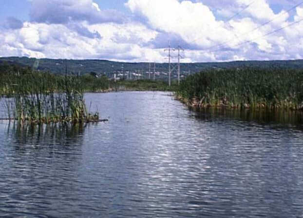
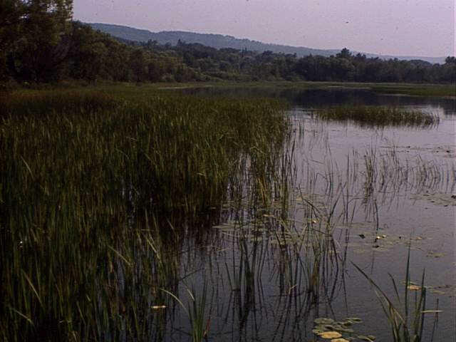
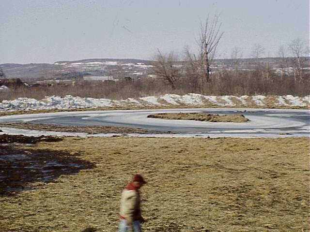
Grassy Point is a small area of wetland where the St. Louis River meets Lake Superior. Although it is only about 100 acres of land, this restoration project is important because it is a part of the vast Lake Superior basin. Grassy Point used to be home to several sawmills which unfortunately left debris behind to clog up the waters. This project eventually removed 11,000 cubic yards of wood debris from the site and reformed several channels during 1994-1996. Debris removal helped the ecosystem to function more naturally, created habitat, and provided an opportunity for several other projects aimed at educating the public and creating a stewardship ethic.
Quick Facts
Project Location:
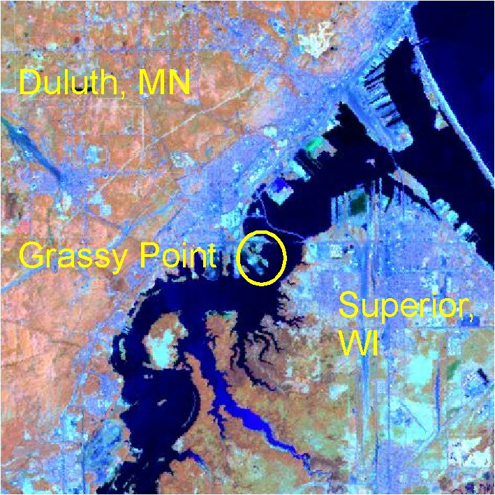
Grassy Point, St. Louis River, 46.7270546, -92.15282730000001
Geographic Region:
North America
Country or Territory:
United States of America
Biome:
Freshwater
Ecosystem:
Estuaries, Marshes & Mangroves
Area being restored:
About 100 acres
Organization Type:
Governmental Body
Location
Project Stage:
Completed
Start Date:
1994-10-01
End Date:
1996-03-31
Primary Causes of Degradation
OtherDegradation Description
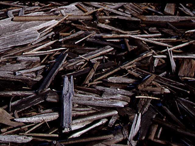
This site was home to many sawmills around the turn of the last century because it gave them great access for shipping. Several different sawmills were located on Grassy Point until 1918 when the Cloquet fires put an end to commercial activity on site. No other commercial use of this site has been documented.
On Grassy Point these saw mills left a tremendous amount of wood waste (more than 16 feet deep in some places) which has hindered the movement of fish and the growth of aquatic vegetation. The waste wood has not significantly decomposed over time and can be found exposed above the surface of the water in many locations.
Reference Ecosystem Description
In 1861, a surveying party charting the mouth of the St. Louis River found an area that was a mosaic of marsh types, likely covered with grasses, sedges, cattail, and other acquatic plants.
Birds identified on site up until the 1970s include Least Bittern, Virginia Rails, Green Heron, Sora Rail, and Snow Goose. This site was important breeding habitat for Ring-billed Gulls and Common terns. This site was also home to Painted and Snapping Turtles in great abundance. This area was also habitat for Northern Pike, Yellow Perch, and Shiners.
Project Goals
This project sought to restore habitat area and ecological function to the Grassy Point wetland by removing the sawmill debris that had been onsite for about ninety years. Although this site has a small area, it fits in with the larger goal of restoring areas within the Lake Superior Basin which is of concern to both the United States and Canada.
Another goal for the project was to increase feelings of public stewardship of the area. As a result of the original project, several projects aimed at increasing public support have been initiated on Grassy Point including:
– Grassy Point public access with a parking lot and park benches
– Removal of additional fill in the wetland that was a result of building a road
– Public access increased by several trail creation projects
– Access blocked for areas where illegal dumping is common
– Control of Purple Loosestrife, an invasive wetland plant
Monitoring
The project does not have a monitoring plan.
Stakeholders
Minnesota Department of Natural Resources
Great Lakes National Program Office of the Environmental Protection Agency (USEPA)
Coastal Services Center, NOAA
Description of Project Activities:
- As early as 1977, Grassy Point and the areas surrounding it were recognized as important habitat for native fish, birds, and wildlife due to the unique mosaic of marsh vegetation types.
- During 1994/1995, DNR hired contractors to describe the location and depth of sawmill waste as well as to determine whether or not there were chemical contaminants buried with the wood.
- They completed 112 borings on 200 foot grid to a depth of 10 feet below the existing surface or 2 feet beyond existing wood waste.
- 4 sediment samples were collected and sent away for analysis.
- Although there were some metals present in the samples, all concentrations came back at "No Effect Level" as defined by the Ontario Ministry of Natural Resources.
- Total PAHs (polycyclic aromatic hydrocarbons) ranged from 0.13 mg/kg to 0.96 mg/kg. All samples were below the Ontario Sediment Quality Guidelines "lowest biological effect" level of 2.0 mg/kg.
- There was no evidence that wood waste was drawing in any organic contaminants or concentrating them as may happen when woody debris is buried in sediment that is contaminated.
- Based on the initial studies, restoration design plans were implemented.
- Excavations were made to connect Keene Creek with the St. Louis River and to create ponds that branched off from this or the main channel. These excavations were to be at the most 6 feet deep and have gently sloping sides.
- During 1995/1996, 11,000 cubic yards of wood waste were removed form the site.
- Baseline data and monitoring data was collected
- Monitoring is reported to be ongoing.
Ecological Outcomes Achieved
Eliminate existing threats to the ecosystem:
Clearing this site of debris opened up habitat for native plants, birds, wildlife, and fish.
In September of 1996, eleven fish species were using the site as a result of the open water areas that had been created.
This project spawned several other projects aimed at increasing public access to this site in hopes to create a sense of public stewardship of the environment.
Factors limiting recovery of the ecosystem:
This site has made the expected recovery due to the restoration action. Grassy Point is part of a greater ecosystem, the Lake Superior Watershed. Anything that affects this watershed such as pollution, loss of species, or lreduced evel of public interest in the environment is likely to affect this site.
Socio-Economic & Community Outcomes Achieved
Economic vitality and local livelihoods:
The removal of 11,000 cubic yards of debris has allowed the ecosystem to function more naturally and given the Minnesota Department of Natural Resources an opportunity to provide educational resources to the public.
Key Lessons Learned
This project is considered a success.
According to the Minnesota DNR, the lessons learned are (from http://www.dnr.state.mn.us/rprp/grassypoint/index.html):
– Degraded areas CAN be enhanced & restored with resourcefulness and planning.
– But the costs of restoring degraded ecosystem function greatly exceed the costs of proactive protection and maintenance.
– Restoring degraded areas can serve as a catalyst for other community-based actions to protect natural resources
Long-Term Management
Monitoring is reported to be on-going. The major causes of the degradation, sawmills, are no longer operating in the area.
Sources and Amounts of Funding
170,000 USD The project main project (removing sawmill debris) was funded by a $170,000 grant by the Great Lakes national Program office of the U.S. Environmental Protection Agency.
State and Local agencies provided matching funds.
Coastal Services Center, NOAA, provided a separate grant to conduct baseline and monitoring surveys.
Other Resources
Pat Collins
Lake Superior Habitat Coordinator
MN DNR – Ecological Services
1568 Highway 2
Two Harbors, MN 55616
Telephone: (218) 834-6612
Fax: (218) 834-6639
Email: [email protected]
Pat Collins’ site for Grassy Point http://www.d.umn.edu/~pcollins/grassy.html
Site for Grassy Point at Minnesota DNR http://www.dnr.state.mn.us/rprp/grassypoint/index.html