Overview
The Wet Woods LIFE Project was funded through the European Union’s LIFE Nature Programme as a series of conservation initiatives on two priority habitats known collectively as ‘wet woods’. The broad aim of the project is to restore and enhance some of the most important areas of bog woodland and floodplain woodland in the United Kingdom, being located on or adjacent to four candidate Special Areas of Conservation (cSAC) designated for these habitats under the EU Habitats Directive: Monadh Mor on the Black Isle; Pitmaduthy in Easter Ross; the Conon Islands on the river Conon; Abernethy in Strathspey; and Inshriach at the foot of the Cairngorms. Although restoration treatments varied by site, they generally included removal of non-native coniferous tree species, thinning of planted Scots pine (Pinus sylvestris), and damming of drainage canals responsible for altering natural hydrologic conditions. The project has proven highly successful, achieving 98% of the stated target for hydrological restoration (363 ha at six sites) and well over the target for habitat restoration (329 ha at six sites). Due to the importance of these woodlands and their inclusion under existing commitments to nature conservation, subsequent monitoring and management activities will be ongoing.
Quick Facts
Project Location:
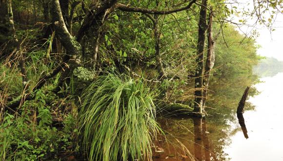
Monadh Mor woodland, Muir of Ord, UK, 57.54154449999999, -4.375218099999984
Geographic Region:
Europe
Country or Territory:
United Kingdom
Biome:
Temperate Forest, Freshwater
Ecosystem:
Freshwater Ponds & Lakes, Temperate Forest - Mixed
Area being restored:
approx. 365 hectares
Organization Type:
Other
Location
Project Stage:
Completed
Start Date:
1998-05-18
End Date:
2002-05-18
Primary Causes of Degradation
Agriculture & Livestock, Invasive Species (native or non-native pests, pathogens or plants), Urbanization, Transportation & IndustryDegradation Description
Despite the fact that the cSAC sites targeted by this project can be counted amongst the best examples of wet woods habitats in the UK, all have experienced some degree of interference with the hydrological systems upon which their integrity depends. Some bog woodland sites, for example, have been drained for agriculture, plantation forestry and other land uses, while similar disturbances in their immediate catchment area have affected the quantity and quality of water entering the system.
The fertile sites of residual alluvial forests have also been cleared for arable farming and grazing or planted with commercial trees. Water use and drainage upstream has, in many cases, altered water quality and seasonal flooding patterns, as have engineering works for flood prevention. These factors, together with the displacement of natural vegetation by exotic trees and shrubs, have led to a decline in the condition of most surviving wet woods.
Reference Ecosystem Description
–Area–
The structure and function of bog woodlands is finely balanced between tree growth and bog development. In a naturally stable system, tree growth is always slow (or the trees would take over the bog), and the trees are likely to be widely-spaced owing to the fact that much of the surface area is too wet for them to establish. Thus, a target to be employed in the implementation of this project will be for “no net loss.”
Loss of bog woodland area to woodland can be assumed when the trees have a closed canopy and the ground vegetation loses the characteristic Sphagnum spp. dominance. If conditions get wetter, loss of bog woodland to bog might be assumed when there are no trees (including stunted trees), or all trees are dead, within approx. 1/2 hectare (70m by 70m square).
–Tree Cover–
A second requirement of bog woodland is that there should be a relatively open canopy. Bog woodland has been defined as the stable condition whereby both the woodland and the bog elements are maintained. This may encompass quite a range of canopy covers from very scattered trees to considerable tree cover; however, canopy closure will lead to the loss of the bog elements. Therefore, an increase in tree seedling establishment and survival may indicate that the bog is likely to be degraded. In most cases, a change to closed canopy should be considered as evidence of deterioration.
An absence of trees could also be interpreted as loss of condition in some instances (assuming they were originally present). Loss of trees could be attributed to browsing pressure, wind throw, burning or water-logging; however, the loss of trees to bog through natural processes would not be considered as evidence of deterioration.
–Range of Tree Ages–
Determining the age of bog pines based on physical characteristics is not always simple, as some stunted pines are of considerable age. Hence, bog trees can be small and stunted or may be over head-height. However, recent research has found that there does appear to be a relationship between the age of bog-pines and their height, and also between tree age and diameter at breast height (DBH)–i.e. even older trees tend to have low height-to-diameter ratios. Most bog trees show signs of being limited by waterlogging and/or nutrient deficiency. They are also characterised by irregular branching (especially on small trees), sparse crowns, short needles, small (if any) cones and mature bark relative to the tree’s height. On some sites, no strong linear relationship was found between height and age, indicating that other factors account for much of the variation in tree size. However, based on this work, some broad generalisations may be possible. If trees are less than 1.5m in height and less than 5cm DBH, have smooth bark and are relatively lichen free, it might be assumed that they are less than 30 years old. Regeneration of bog pines may only occur sporadically following a succession of dry summers; therefore, evidence of regeneration may not be expected at any given time. However, in order to ensure some continuity of tree presence, there should at least be some trees that appear to be in this <30 year old cohort. It should also be expected that there are some older trees, either of greater height or diameter, and perhaps also some dead trees. Lichens tend to be more abundant on older pine trees; hence older specimens may have significant cover of crustose species.
–Micro-topography–
Most natural, undisturbed bog surfaces usually show distinctive fine-scale variation, with small, drier hummocks and wetter hollows related to growth of Sphagnum and other plants. Bog woodland sites might therefore be expected to contain some of the following. (These may be absent or reduced on cut-over or relatively recently formed bogs):
– Hummocks – mounds of Sphagnum which can be up to 1m high and 1-2m in diameter
– High ridges – characterised by a dominance of dwarf shrubs, particularly heather (Calluna vulgaris), often growing in a senescent Sphagnum carpet.
– Low ridges – distinguished from high ridges because they tend to be far less dominated by dwarf shrubs. They are characteristic of soft, undamaged mire systems, in which they constitute the major ridge component.
– Sphagnum hollows – Although free water is often not visible, the dense carpet of Sphagnum sits in an aqueous matrix and cannot support any great weight.
– Mud-bottom hollows – as above but limited in its moss cover and exhibiting a significant occurrence of higher plants.
–Bare Ground–
Bare patches in peatlands may be caused by peat cutting or erosion due to herbivore trampling, burning and/or considerable fluctuations in water levels. Deer wallows can create valuable habitats for invertebrates, and white beak-sedge (Rhynchospora alba) is sometimes found near such wallows. However, expanses of bare ground would generally be perceived as a negative indicator of condition. The target could be for a maximum acceptable area and/or proportion of the site, e.g. no more than 5% of site area and no individual area greater than 100sq m (0.01 ha).
–Water levels–
There are long-term natural cycles (decades) of drying and wetting related to natural variations in climate, which cause changes in the bog vegetation. However, the water table would be expected to be just below the surface for the majority of the year. A combination of the following factors can be used to assess if this appears to be the case:
– Sphagnum spp. frequent over the majority of the site
– there are no/few active drains
– peat cutting/extraction is absent
– there are no/few erosion channels which are not vegetated
– ground feels soft/wet underfoot
– As the water level can vary throughout the year, the vegetation is probably the best indicator of year round water levels.
Project Goals
The overarching aim of the Wet Woods Restoration Project was to restore and enhance some of the most important areas of bog woodland and floodplain woodland in the United Kingdom and to remove or mitigate existing threats to these rare habitat types.
Objectives encompassed within the broader aim of the project are:
–to restore significant areas of wet wood habitat on or adjacent to sites that are candidate Special Areas of Conservation (cSAC) through the reinstatement of more natural hydrological systems, restructuring of surrounding plantation forests, creation of buffer zones of native woodlands, and removal or control of exotic trees and shrubs
–to undertake scientific research into the history of bog woodland management and incorporate remote sensing data to inform restoration, management and monitoring plans for wet woods habitats
–to use the existing network of partner institutions to disseminate information gained throughout the project and encourage an integrated approach to the conservation of wet woods
–to support the development of partnerships between public agencies and private landowners.
Monitoring
The project does not have a monitoring plan.
Description of Project Activities:
--Monadh Mor--
Restoration work at this site focused on an 82-hectare plantation planted on bog woodland north-east of and directly adjacent to the Monadh Mor cSAC. The plantation contained a mix of non-native conifers (principally Pinus contorta) with Scots pine (Pinus sylvestris) planted on the drier areas. The following specific targets were identified:
- Removal of all exotic and non-natural coniferous tree species from a total of 82 hectares, mostly adjacent to the cSAC.
- Removal of all trees planted on wet areas, with the exception of natural form Scots pines at the fringes
- Heavily thin remaining planted Scots pine
- Carry out hydrological works (i.e. drain blocking) over a total area of 104 hectares--22 hectares within the cSAC and 82 hectares adjacent to the cSAC.
- Overall target: the restoration of conditions favourable for the continuation and expansion of bog woodland habitat over a total area of 104 hectares.
For the forestry work, two main harvesting/felling methods were used. For trees of marketable size, felling and delimbing was done by harvester with extraction by forwarder. For trees of non-marketable size, felling was done by chainsaw, with felled trees cut into shorter lengths to assist brash breakdown. On the wettest, most sensitive areas, felled trees were carefully extracted either manually or by winch.
The first phase of the restoration programme began in February 1999 with the harvester/forwarder extraction method carried out by Forest Enterprise's (FE) own staff and machines. The harvester was particularly effective, as it had the ability to concentrate brash material, allowing the early recovery of a greater proportion of the vegetation. Damage through machine use was impressively minimal. As conditions got wetter into winter, machines with wider-than-normal tyres were used to reduce ground damage. It was necessary to move brash to protect the ground. Throughout the harvesting operation, watercourses were bridged using timber/brash bridges with piping to allow waterflow. Upon completion of the extraction, and following a detailed hydrological assessment, these bridging points were altered where necessary to become drain blocking dams.
The second phase of the restoration was carried out by a local contractor and began in early August 1999 with the first attempts at thinning the planted Scots pine on the drier knolls. LOPT discussions agreed on the following points of guidance for the forester:
- overall thinning intensity of c. 50%
- reduce uniformity by leaving some thicker clumps i.e. some areas 30%, some 70%
- sculpt straight edges
- lose rides and thinning racks
- generally aim to take out the straighter "˜pole' trees and leave those with a more natural form.
For both phases of work, supervision was largely by FE, with LOPT meetings on-site as required to assess the work. By the 1st October 1999, a total of 36 hectares had been completed.
The third phase of the work was the "˜fell to recycle' programme for Area 2. This again was carried out by a local contractor and concentrated on many of the more sensitive wetter areas where machines could not work.
The fourth phase of the work was the hydrological re-instatement (or drain blocking) work. The principal technique was machine-dug peat dams spaced approximately 10 metres apart. The digger (6 tonne, Hymac) constructed the dams by digging out saturated peat from the side or bottom of the drain and using that as the bulk of the dam. The turf scraped off to access the saturated peat was then used as a "˜top' for the dam. In areas of shallow peat, dams had to be made out of the mineral soil. As much of the underlying soil at Monadh Mor is clay, the dams are thus far holding up very well; however, experience from previous LIFE projects has shown that dams of the more porous sandy soils can be much less effective. Overall, the drain blocking at Monadh Mor has worked well with, again, much emphasis on the importance of a skilled operator and close quality control. All the drain blocking work was completed by a local contractor, who also carried out some essential road/track improvements to facilitate access for monitoring and light recreation.
The restoration work in the smaller area within the original cSAC (Area 1) was completed in January-February 2000 and amounted to a combination of tree removal and drain blocking. The tree removal was largely lodgepole pine and sitka spruce regeneration principally near the edge of a once afforested morainic peninsula which juts out on the southern boundary of the cSAC. As much of the regeneration was on very wet bog, there were problems in separating out the non-native lodgepole pine with the native Scots pine, as both species can look very similar in high water table conditions.
The final year was one of mainly care and maintenance with some tidying up completed and improvements made as necessary. One km of redundant internal fencing was removed to both improve the visual aspects and eliminate the potential threat of birdstrike. Another unplanned activity was the removal of the remains of 3 wrecked vehicles from the site.
--Inshriach--
The forest at Inshriach is owned by the Forestry Commission and largely comprises young lodgepole pine and Scots pine plantation, although there are significant remnants of bog woodland in varying condition. Restoration work originally focused on an area of mixed conifer and non-native regeneration which bordered a canalised and relatively fast flowing watercourse (Allt a Mharcaidh). The Inshriach LOPT agreed on the following prescriptions for the site:
- The removal of mixed conifers and non-native regeneration over an area of 40 hectares adjacent to the Allt a Mharcaidh
- The heavy thinning of planted Scots pine
- The blocking of key drains within this area
The restoration programme began in July 1999 with the harvester/forwarder extraction method. Larger trees of marketable size were felled by a mechanical harvester and extracted by a forwarder machine. Progress was excellent with completion of the 20 hectare contract by the end of August 1999. The harvester was particularly effective as it had an ability to concentrate brash material allowing the early recovery of a greater proportion of the vegetation. Damage through machine use was impressively minimal although this was helped by a good dry spell of weather. Throughout the harvesting operation, watercourses were bridged using timber/brash bridges with piping to allow waterflow. As with the Monadh Mor site, upon completion of the extraction, these bridging points were altered where necessary to become drain blocking dams. Areas of pure planted Scots pine on the drier morainic deposits were retained, but thinned to a more natural structure to increase the chances of recovery of the ground vegetation.
The second phase of the work at Inshriach was carried out in January 2000 and focused on the more waterlogged areas where regenerated lodgepole pine was removed by chainsaw and cross-cut to encourage rapid natural decay. Both phases of felling work were undertaken by a local contractor and completed ahead of schedule and within budget.
Following tree removal, the hydrological reinstatement work was carried out in May 2000. During the final year of the project a number of small areas totalling 0.5 ha were tidied up with the removal of missed individual trees. In the spring of 2001, an estimated 80% of the brash over the entire area was raked into approximately 200 piles located on mineral soils. The majority of these were burnt during the early winter of 2001, but some will were left as controls to see whether they will be beneficial to invertebrates or provide cover for birds and mammals.
--Abernethy--
As the most complex of the project sites, Abernethy is divided into four management units: Mondhuie, North Abernethy, Dell Wood and Garten Wood.
Tree felling at Mondhuie started in early July 1998 on a plantation of lodgepole pine, and by November 1998, 21.7 ha had been felled. Progress was slow due to the shape and form of the trees, many of which had several main stems. Consequently, felling was done by hand with chainsaws rather than by the cheaper harvester/forwarder method. The second phase began in November 1998 with a harvester/forwarder contract to extract the more marketable timber. This was completed by February 1999 and increased the felled area by another 24 ha. The third phase of tree felling was carried out between August 1999 and March 2000 over an additional area of 24 ha. A fourth felling phase at Mondhuie began in February 2000 using a harvester/forwarder contract. This was a no-cost operation as the extracted timber covered the cost of the machines involved in carrying out the work. An area of 18.5 ha was cleared by April 2000. The final stage at Mondhuie involved felling by hand over approximately 14.1 ha and was completed by February 2001.
The large scale of felling at this site meant that a considerable area was covered by brash. Given the scale of the removal task it was decided to leave the brash on site and compare the development of the area with other areas outwith Mondhuie where brash removal (mainly by burning on site) has taken place.
Drain blocking at Mondhuie commenced in March 1999 with the damming of the two main drainage systems on the south side of the site. The principal technique involved machine-dug peat dams spaced approximately 10 metres apart. A 6-tonne Hymac digger was employed to dig out saturated peat from the side or bottom of the drain for use in construction of the bulk of the dam. The vegetation scraped off the surface of the peat was then used as a top for the dam.
In November 2000, 14 peat dams collapsed following several days of very heavy rain. Immediate remedial work involved the removal of peat debris in drains on the site and clearing two culverts running under the adjacent public road. The collapse was considered a result of the unsuitability of peat dams to control such large volumes of water. However, the event exacerbated the concerns of a neighbouring tenant farmer and landowner who held the restoration work responsible for increased wetting of their land. The Scottish Agricultural College was therefore contracted to review the impact of the restoration work on local hydrology. Their report showed that although, as expected, tree felling had increased the water run-off, the main problems experienced on the adjacent land were a result of recent increased rainfall and lack of maintenance of field drains. Consequently, field drains adjacent to the site were cleared and three metal pile dams were constructed in the main drain where the collapse had occurred. An additional fourth metal pile dam was installed in March 2002 to consolidate the earlier work.
Most of the work in North Abernethy involved drain blocking, focusing on areas where earlier restoration had been carried out. Initially there was not thought to be any need for habitat restoration at North Abernethy, but subsequent investigation highlighted the additional need for some tree removal. Local contractors removed planted Scots pine from an area of 1.6 ha of ploughed and planted peatland in August 1999, along with 8.7 ha of dense, naturally regenerated Scots pine on drained peatland. A total of 10.3 ha were therefore restored by tree removal.
The first phase of drain blocking at North Abernethy started in March 1999 as a continuation of the work at Mondhuie. The work included two techniques--complete filling of drains in two areas and the installation of peat dams at intervals along drains at two other sites. In all, 13.6 ha of peatland was restored by the end of the contract. The second phase of restoration work revisited areas where earlier attempts at re-wetting had not achieved their objectives and was carried out in the autumn of 1999. This work involved filling in the plough lines using two 6-tonne Hymac diggers in a technique not before employed at Abernethy. Initial results in these areas have been very encouraging. This phase of the work resulted in the restoration of 21.5 ha of wetland.
Dell Wood is part of the Abernethy Dell Wood National Nature Reserve, of which some 266 ha are owned and managed by Scottish Natural Heritage, with another 108 ha leased from the RSPB. It contains extensive areas of bog woodland, many of which have been subject to the effects of drainage and forestry. An area to the south of Nethy Bridge was drained and planted with lodgepole pine in the 1970s, with approximately 5 ha planted on peatland. These 5 ha were felled (as part of a larger felling exercise designed to benefit Caledonian pinewood) in September and October 1999, after consultation with the local community of Nethy Bridge who make use of the area for light recreation. There was no adverse reaction to the project proposals. As a demonstration of an alternative brash disposal technique, it was decided that rather than being left on the site, the brash should be gathered into large heaps and later burned. Burning began in November 2000 and continued when weather and ground conditions allowed, although these operations were later delayed as a result of foot and mouth restrictions imposed in February 2001. SNH labour was used for the brash burning, augmented by contractors. Although no dams were built, the felled timber was used to infill the drains and this, in conjunction with the tree removal, has resulted in the area becoming re-wetted.
The more intact 'drained only' part of the Dell Wood bog woodland was targeted in August-September 2001, with a contractor employed to install 30 hand-built dams. This has resulted in drains being blocked over an area of approximately 14 ha.
Most of the project's work at Garten Wood was carried out in November and December of 1999 over an area of approximately 25.4 ha. Plastic piling material was used to construct dams by hand in areas where drain blocking had not previously taken place. In areas of consolidation, new dams were constructed next to the originals, using Scots pine logs with locally dug peat infill and vegetated tops. This work was also carried out by hand to prevent excessive damage to the bog by machinery.
--Pitmaduthy--
At the outset of the project, there were two main threats perceived to the bog woodland at Pitmaduthy Moss. The site was considered to be under a degree of threat of drying out from the adjacent plantation of lodgepole pine (Pinus contorta), and this plantation also appeared to be a seed source for invasion of the site.
Fertiliser spray drift and run-off from agricultural land directly adjacent to the northern margin of the site was thought to be causing nutrient enrichment. It was believed such enrichment could significantly increase the growth of existing trees, encourage tree regeneration and alter the vegetation structure typical of nutrient-poor bog woodlands.
The hydrological survey of the site carried out in June and July of 1999 concluded that there was already a healthy semi-native pinewood buffer zone between the plantation and the bog and there was no evidence of any negative effect. Thus, it was advised that tree removal should not be an objective on this site.
--Conon Islands--
The management targets for this site were:
- The restoration of 27 ha of alluvial woodland by the felling of invasive sycamore (Acer psuedoplatanus) and the removal of the exotic shrub Physocarpus opulifolus
- The upgrading of 200 metres of the River Conon Walk footpath in order to divert visitors away from sensitive areas of the site
- The fencing of areas where stock access was thought to be causing damage to the alluvial woodland
The main work of the restoration project involved the felling and cutting of exotic species, which was carried out by a combination of manual cutting, mechanical flailing, and in some cases, actually pulling up plants by hand. Stumps were treated with a systemic herbicide as appropriate. It was accepted that complete eradication of the target species was not a realistic objective, especially given the dynamic nature of the floodplain woodland habitat. However, it is envisaged that ongoing control requirements would be built into the development of a management stategy for the Conon.
The first stage of restoration work was completed in June 2000 with the felling of sycamore from 3 ha in the Kildun Farm area of the site. This was part of a Woodland Grant Scheme, which also included the maintenance of existing stock fencing and the improvement of a public footpath to enable light access to continue. This area was revisited in 2001 when the Physocarpus was cut, and again in 2002, when the regrowth was sprayed. Work on the clearance of exotic trees within Garrie Island began in autumn 2000, and by May 2001, approximately 5.9 ha had been cleared of sycamore. The Physocarpus was then cut and, as above, the regrowth sprayed in 2002. Further upstream, a strip of 8.3 ha dominated by sycamore and rhododendron was cleared and the regrowth also treated in 2002. All restoration work at Conon Islands was undertaken by local contractors. In total an area of just over 17 ha was restored to allow for the development of natural alluvial woodlands. Although this is slightly less than the amended target, it does represent a significant piece of work in this delicate ecosystem. Work in this potentially very wet environment can mean that windows of opportunity for work are restricted, particularly in wet winters such as occurred in 2001/2002.
--Lower River Spey--
The Lower River Spey was not part of the original project bid, but as a result of a predicted project underspend, a bid was submitted in March 2001 to continue with work already undertaken within the cSAC. The Culriach Woods section of the floodplain woodland at this site has been adversely affected by the planting of conifers in the 1950s. Forest Enterprise had completed some conifer removal prior to the start of the Project but since this time there had been significant regrowth of exotic broadleaved trees, principally sycamore (Acer pseudoplatanus). Other non-native shrubs and plants are also present. On disturbed ground, these exotics can rapidly displace natural floodplain communities if native species are not quickly established. The objectives for this site therefore concentrate on assisting the regeneration of native species, as follows:
- The removal of remaining brash to promote the regeneration of floodplain woodland
- The treatment with an appropriate herbicide of sycamore stumps where re-growth is occurring
- Plantation of native floodplain trees with appropriate fencing to assist regeneration
- Provision of interpretative boards and signs to describe the ongoing work and its purpose to walkers using the Speyside Way path adjacent to the restoration area.
Restoration work at Lower River Spey was undertaken by Forest Enterprise staff. Initially, brash from previous felling was gathered into heaps and then taken off site. The next step involved the use of chainsaws to fell sycamore. Treatment of the stumps was also carried out by hand, with herbicide injected into the fresh stumps. A mixture of native tree species was planted in the areas where felling had taken place, and this was fenced to prevent browsing of the young trees by deer. Given that the River Spey is prone to flooding within this site, it is important to work when weather conditions allow, and therefore, a season's work had already been completed before approval of the bid for this site was given in October 2001. Thus, no claim for management work was submitted as part of the project costings. As owners, Forest Enterprise will continue to undertake sympathetic management of this floodplain woodland area.
Ecological Outcomes Achieved
Eliminate existing threats to the ecosystem:
Monadh Mor
- Hydrological integrity restored over 103.3 ha of the restoration area.
- Felling of non-native conifers and thinning of plantation Scots pine over a total area of 142.6 ha.
- Removal of 1 km of redundant fencing from the site to improve visual aspects and reduce the potential for birdstrike.
- Two new gates provided to allow access for visitors on foot or bicycle and the addition of waymarkers on the route through the restored areas.
- Two interpretation panels erected on site.
- Guided tours given to various groups including the Inverness Botany Group and junior rangers (12-17 years old) from various country parks in Glasgow.
Inshriach
- Habitat and hydrology on over 52 ha have been restored to a condition that will allow bog woodland to develop naturally within a natural pinewood on this site. This forms part of a larger 146-ha area which was submitted to the European Commission on 29 January 2001 as a mixture of bog woodland and Caledonian Forest.
- Two interpretative panels have been installed.
- Guided site visits were given by Forest Enterprise staff to a number of groups including the Keilder LIFE bog restoration project, Centre for Ecology & Hydrology staff, and participants of the end-of-project conference.
Abernethy
- Drains blocked over a total of 207.5 ha
- Trees removed from an area of 116.9 ha
- Two new information panels installed at Mondhuie on the Speyside Way long-distance footpath. These explained the need for tree removal and drain blocking and highlighted the benefits to wildlife
- Guided visits undertaken to various areas within Abernethy for a number of parties, including Prince Charles, the Native Woodland Habitat Action Plan group, the Border Mires LIFE team and delegates from the Final Conference
Canon Islands
- Restoration of floodplain woodland over an area of 17.2 ha.
- Provision of interpretation boards and signage at key points, describing the value of the habitat and the aims of the restoration work.
- Completion of a historical survey of the River Conon. This survey looked at three main issues that could alter river hydrology: deforestation, hydroelectric dam construction, and construction of floodbanks and installation of field drainage systems. The report considers management options which relate to local impacts and will inform the development of a stategy for the area.
- Completion of a report on the Residual Alluvial Woodlands of the River Conon. This report provided an overall description of the present state of the riparian habitat mosaics and the dynamics of the river and its floodplain, with the ultimate aim of determining activities which will maximise the conservation value of the alluvial woodlands in this location.
Lower River Spey
- Installation of two interpretation panels adjacent to the site on the long-distance Speyside Way footpath.
- Approximately 20 ha of restored floodplain woodland on the Lower River Spey candidate SAC (N.B. This work was not funded by the LIFE Project)
Factors limiting recovery of the ecosystem:
The early indications are that bog woodland aspects of the project have been particularly successful in spite of early complications. These illustrated the problems associated with developing programmes such as this. Parts of the areas that have been restored were very degraded, and it was difficult to accurately assess before the work began what the situation would be on the ground with respect to its hydrological state. Also, it was difficult to assess the ability of machines to carry out the work, and in many cases (e.g. Mondhuie), much of the work had to be done manually. This is much more expensive and time consuming than machine felling. More accurate preliminary mapping would have reduced the uncertainties, and certainly the experience of this project, and the recent improvement in digital mapping techniques, will mean that any future work will be based on a more accurate understanding of the problem.
Socio-Economic & Community Outcomes Achieved
Economic vitality and local livelihoods:
The main measurable socio-economic benefit that this project has brought has been the work that has been carried out by local contractors. All of the project locations can be considered economically vulnerable, where opportunities for rural employment are often at a premium. Although much of the work is one off, the project has been quite labour intensive in many instances (as shown by the need to hand-fell 63 ha at Mondhuie) and has provided opportunities for local contractors during this period. Furthermore, the novel nature of the work has allowed local contractors to develop new skills which will prove to be useful as they seek new contracts. It also benefits the sites directly, as there is now an experienced group of contractors who are used the different requirements of conservation, as opposed to economically-led management.
Key Lessons Learned
As a result of the project, there are now no major areas within the sites that will require further significant work. All will be monitored as part of SNH’s Site Condition Monitoring (SCM) programme, and some will be subject to more specific local monitoring to measure success and progress, and also to determine whether any remedial work is required. Owing to project efforts, an additional 214.3 ha of bog woodland habitat was submitted to the EC as additions to the Monadh Mor and Cairngorm cSAC on 29 January 2001. The area associated with the restoration of the Conon is considerably less; however, it has nevertheless been significant and considerably more than originally planned. The problems associated with the Conon are more or less restricted to the presence of exotic species, as the component parts of the cSAC are located on areas close to the River Conon where the hydrological regime is less altered than areas back from the river. The presence of exotics within the rest of the catchment will mean that there is a continuing need to monitor the site and take remedial action as necessary. However, because of the major work that has been achieved by the project, the need for further work will be considerably reduced. The developing Conon strategy already appears to be paying dividends. The work that has been undertaken has raised the profile of the conservation issues and resulted in new proposals being brought forward. The suggested restoration of residual alluvial woodland and the development of a new salmon spawning redd along the old river channel on Dunglass Island, for example, is the direct result of discussions about the Conon Strategy. An approach from a land manager about the control of Himalayan Balsam on the lower Conon has also been inspired by the work undertaken as part of the project to deal with rhododendron and Physocarpus. Both of these possible future projects show a desire to become involved in partnership working to produce results on the ground.
The Wet Woods Project has built upon and strengthened working relationships that have been developed among members of the Caledonian Partnership over a number of years of involvement with LIFE Projects. This close liaison will be invaluable as other LIFE Projects, such as the Capercaillie Project, and other such joint working opportunities arise.
Long-Term Management
Approximately 95% of the project area lies within land owned by Forest Enterprise, Scottish Natural Heritage or the RSPB and is therefore covered by existing commitments to manage these areas for long-term nature conservation. All of the other areas are also underpinned by domestic legislation, as they are parts of larger Sites of Special Scientific Interest and will therefore be afforded the protection provided by this designation. All of the sites will be monitored as part of SNH’s Site Condition Monitoring programme and some (e.g. Mondhuie) will be subject to more intensive surveying. Although at this stage there are not thought to be any outstanding issues, it is felt that there are sufficient systems in place to ensure that any work identified as a result of monitoring will be undertaken. The move from merely preventing deterioration of the cSAC habitats to their enhancement and expansion will take several woodland cycles. The management of alien exotics is also a long-term project. Due to their invasive nature, some species may need control over several years or may re-invade following initial eradication. The control of these species will therefore have to continue for several years beyond the life of the project and will need the support of public funding in the form of SFGS, grants and agri-environment schemes.
The development of sustainable management practices for the floodplain woodland of the River Conon is likely to take several years. Although the cSAC is limited to the series of wooded islands towards the mouth of the river, the extent and distribution of alluvial woodland is dependent on the dynamics of the river system as a whole. Many of the floodplain sites have been protected from inundation by embankments and bunds to allow for agriculture and grazing, and the natural dynamics of the river have been inhibited along many stretches. Thus, there is a need to restore the context in which these woods originally developed, which will require consideration of land use and woodland communities outside the designated boundaries. It is therefore considered essential for the future management of the cSAC to develop an integrated management plan for the wider river system which will, as far as possible, allow the natural hydrology to be restored. The dissemination of SNH’s Conon Strategy to the other stakeholders and the possible formation of a management group over the next two years is the start of the process.
Sources and Amounts of Funding
551,959.36 pounds sterling (£) The Partnership received funding from the European Union’s LIFE-Nature Programme. Restoration work carried out on privately owned land received match funding from the Forestry Commission’s Woodland Grant Scheme.
Other Resources
Project Site
http://www.wetwoods.org/