Overview
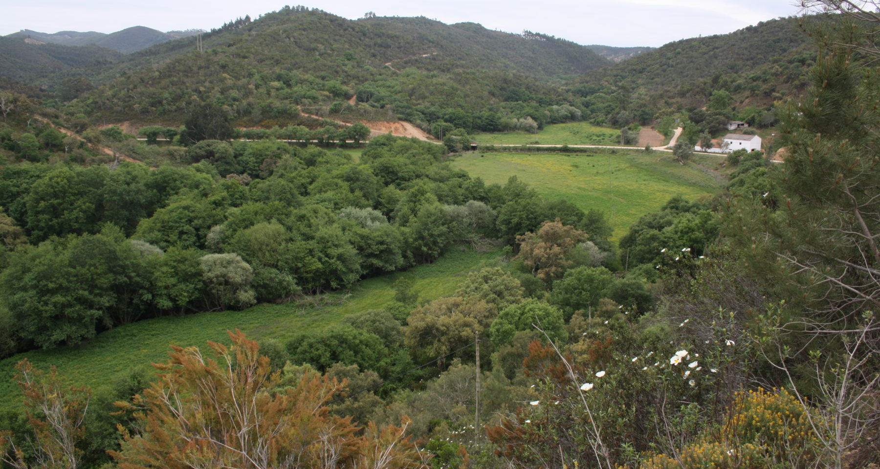
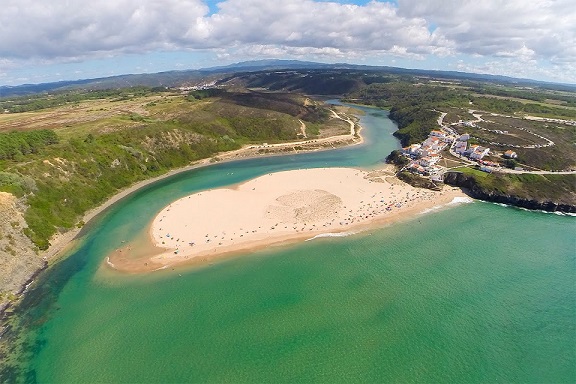
This is a landscape-based project, using the Seixe River basin (watershed/catchment) as the unit for analysis. Nature Conservation Instruments, a protected area, 2 Natura 2000 network sites and an Important Bird and Biodiversity area overlap to provide protection for 93% of the project area. Ecologically this is an area of high biodiversity, which has legal protection but little, to no, actual protection in place. Socially, around 50% of the area is used for eucalyptus plantations (pulp and biomass) production, the area is used for local small-scale agricultural production and, over the last 30 years or so, has seen a large number of land-plots being abandoned. The goal is to restore biodiversity and ecosystems via an integrated management (plan) as a participative and consultative process as all land is owned privately. Restoration will be done based on current/on-going ecological studies, and will be at the behest of land-owners, or in collaboration with local municipal authorities where land has been abandoned. So far, apart from setting up a strategic partnership platform (11 institutional and organisational partners) the project, which started in July 2016, has a long way to go.
Quick Facts
Project Location:
Seixe River, Portugal, 37.4078957, -8.716492199999948
Geographic Region:
Europe
Country or Territory:
Portugal
Biome:
Temperate Forest
Ecosystem:
Temperate Forest - Mixed
Area being restored:
Unknown at present.
Project Lead:
GEOTA (Environmental NGO) working with 4 universities.
Organization Type:
NGO / Nonprofit Organization
Project Partners:
Aljezur Municipality & Odeceixe Parish (Algarve region).
Monchique Municipality (Algarve region).
Odemira municipality (Alentejo region).
Institute for Nature Conservation and Forest (ICNF).
Environmental Agency (APA).
Lisbon University.
Algarve University.
Évora University.
Nova University.
VICENTINA - Local development association.
Location
Project Stage:
Planning / Design
Start Date:
2016-07
End Date:
2021-07
Planning \ Design:
24
Implementation:
12
Post-Implementation Maintenance:
36
Monitoring & Evaluation:
60
Primary Causes of Degradation
Agriculture & Livestock, Deforestation, Fire & Weather Events, Fragmentation, OtherDegradation Description
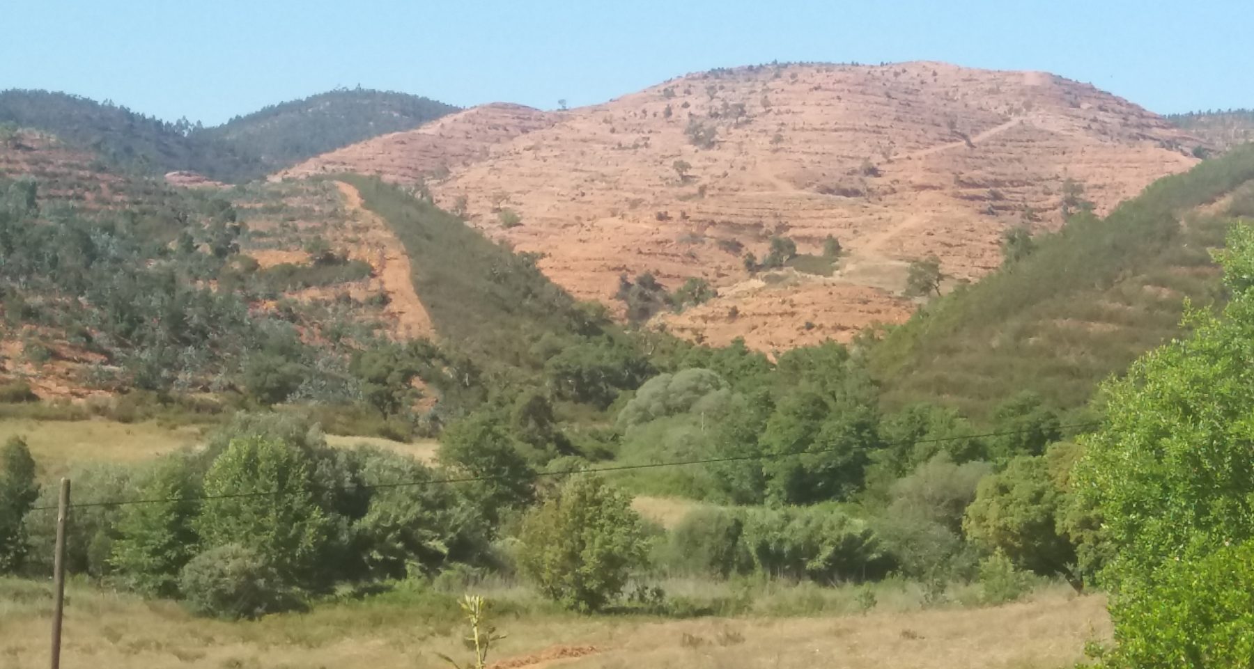
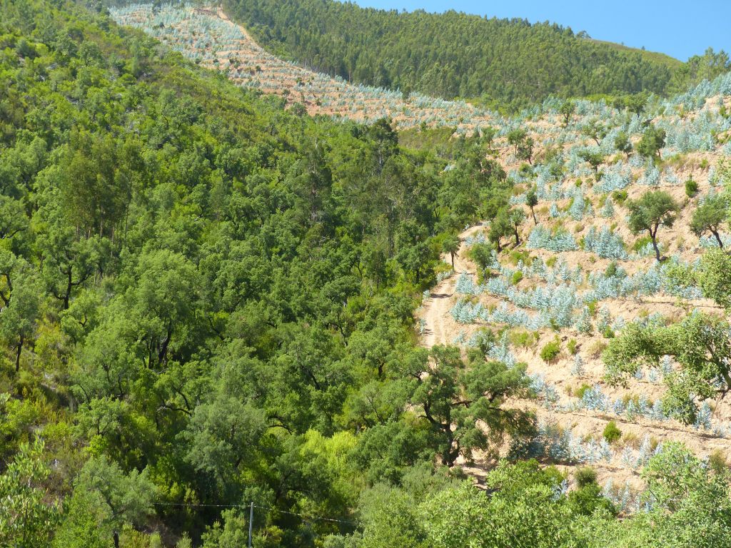
Main cause: land use, i.e. the development of eucalyptus plantations – land clearing. Underlying causes: land abandonment after agricultural use.
Effects on ecosystem structure/function, impacts on biodiversity: land clearing and development of terraces for planting of monoculture plantations (simplified ecosystem) destroys biodiversity and severely degrades natural ecosystems.
Landscape-scale: concern over ecosystem services, desertification and climate change impacts (studies being conducted).
Socioeconomic: questions around sustainability of socioeconomic environment (studies being conducted).
Political factors: decision-making and policies (hence reason for strategic partnerships).
Defining the Reference Ecosystem
The reference ecosystem is based on diverse sources of information (e.g. multiple extant reference sites, field indicators, historical records, predictive data).Reference Ecosystem Description
Studies are being conducted – ongoing. Expect results in 4-6 months.
Project Goals
- To restore the natural functioning and protection for inherent ecosystems in the river basin;
- To develop and implement an Integrated Management Plan for the sustainable management of land and forests, and to ensure the conservation of biodiversity and the restoration of degraded or destroyed ecosystems;
- To define a green infrastructure for integration into a broad network of ecological corridors from a multifunctional landscape perspective;
- To create a climate refuge that constitutes an experimental and demonstration area for climate change adaptation and mitigation;
- To develop an Environmental Centre to support environmental education, ecotourism, research and scientific tourism at the international level, with a view to supporting future rural area development and river basin management.
Monitoring
The project does not have a monitoring plan.
Stakeholders
Landowners and land-users: an ongoing process working with the 3 municipal authorities by following a public participation process (informative, participative and consultative) with the aim of establishing ownership for the actions needed to create a sustainable future for the people of the Seixe River Basin.
Planning process: as land is private, the project will, via the municipal authorities, engage with stakeholders to develop an Integrated Management Plan. For restoration purposes, the project, via the municipal authorities, engages with landowners to establish sub-projects for land-use planning (zoning and socioeconomic) and for ecological restoration based on the network of ecological corridors.
Education and outreach: the project has a schools programme for environmental education, and will engage in public workshops for awareness building and dissemination of information. A project website is under construction as well. The overall aim is to develop a ‘citizen-science’ outreach that involves as many youth as possible, bit that caters for adults and other interested parties.
Description of Project Activities:
No restoration activities have, as yet, been carried out - owing to the project dynamics, i.e. private land, this process will take some time to bed-down.
How this project eliminated existing threats to the ecosystem:
As above.
How this project reinstated appropriate physical conditions (e.g. hydrology, substrate)",:
As above.
How this project achieved a desirable species composition:
As above.
How this project reinstated structural diversity (e.g. strata, faunal food webs, spatial habitat diversity):
As above.
How this project recovered ecosystem functionality (e.g. nutrient cycling, plant-animal interactions, normal stressors):
As above.
How this project reestablished external exchanges with the surrounding landscape (e.g. migration, gene flow, hydrology):
As above.
Activities were undertaken to address any socio-economic aspects of the project:
Studies are being undertaken to understand this aspect of the project. Once completed, an assessment will be done to determine which socio-economic activities are best suited to the area (bearing in mind it is a conservation area), and how best to institute these activities as the area is comprised of private land.
Ecological Outcomes Achieved
Eliminate existing threats to the ecosystem:
No activities have, as yet, been undertaken.
Reinstate appropriate physical conditions",:
As above.
Achieve a desirable species composition:
As above.
Reinstate structural diversity:
As above.
Recover ecosystem functionality:
As above.
Reestablish external exchanges with the surrounding landscape:
As above.
Factors limiting recovery of the ecosystem:
As above.
Socio-Economic & Community Outcomes Achieved
Economic vitality and local livelihoods:
This aspect of the project is still in its initial stages: Studies have not yet been completed, and as such, no activities have been initiated.
Provision of basic necessities such as food, water, timber, fiber, fuel, etc.:
As above.
Cultural dimensions such as recreational, aesthetic and/or spiritual:
As above.
Regulation of climate, floods, disease, erosion, water quality, etc.:
As above.
Has the project had any negative consequences for surrounding communities or given rise to new socio-economic or political challenges?:
As above.
Key Lessons Learned
Not applicable, project is still in (early) planning phase and many aspects, which include the (vital) public participation processes have yet to be initiated.
Long-Term Management
Not applicable, project is still in (early) planning phase, and, although a strategic framework exists, this still has to be refined and described as the public participation process has not yet been initiated.
Sources and Amounts of Funding
Funding has been difficult – this project does not fit with many of the criteria set for funding. The main problem being the holistic approach to ecological restoration, i.e. via a ´living system´ or landscape-based project development. To date, the partner of GEOTA, a local NGO run by an avid environmentalist, has provided over 50% of the funds to establish a project management team, 2 persons. A regional fund is also supporting the project by providing funding for research studies which now involves the universities as well as the regional development association.
The aim is to apply to the EU LIFE fund later this year.
Other Resources
The website is under construction. However, should anyone want information regarding this project they can do so via this email address: [email protected].
Primary Contact
Name:
Justin Roborg-Söndergaard
Affiliation:
GEOTA/Project Strategic Coordinator
City:
Lisbon
State:
Lisbon
Organizational Contact
Name:
Miguel Jerónimo
Affiliation:
GEOTA/Project Manager
City:
Lisbon
Email:
[email protected]


