Overview
Efficient ecological restoration must assess ecological and socio-economic costs and benefits of these actions, valorize and harmonize them, and define priorities to maximize their positive outcomes. TERECOVA will create tools to prioritize restoration actions in heterogeneous Mediterranean landscapes by means of participative processes that integrate society visions and aspirations.
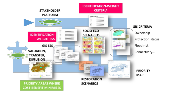
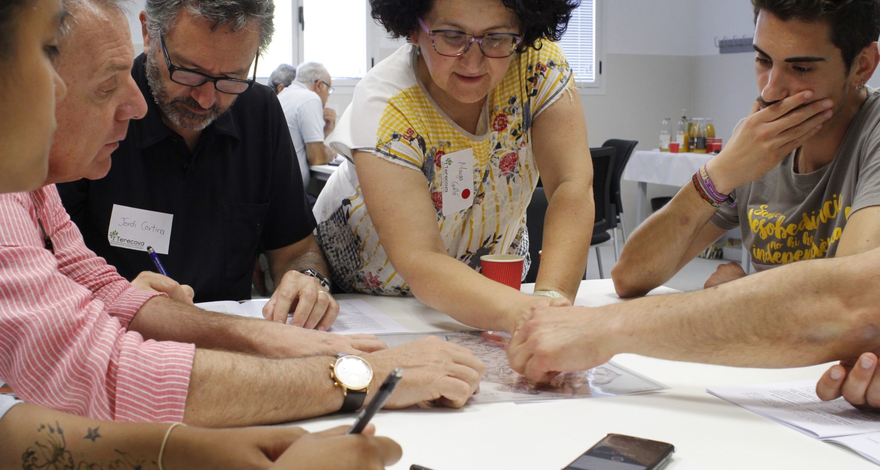
We have established stakeholder platforms in two Mediterranean regions. Hundred of participants have identified prioritization criteria, the main services provided by ecosystems present in each area and they have weighted all of them. All the criteria, services and indicators identified have been mapped.
By using expert knowledge and the integrated provision of ecosystem services, we will estimate the difference in the provision of ecosystem services between current and potential (reference) conditions by ecological restoration. We will also estimate the monetary costs of ecological restoration. An effectiveness analysis (by combining priority maps and cost) could identify areas with highest increases in the provision of ecosystem services at the lowest cost. And the adopted protocols allowed to invest in ecological restoration will fulfill society aspirations.
Maps will be used to collectively discuss restoration options, and promote and drive future investments from the public and the private sectors, and private-public cooperation.
Quick Facts
Project Location:
Spain, 40.46366700000001, -3.7492200000000366
Geographic Region:
Europe
Country or Territory:
Spain
Biome:
Desert/Arid Land
Ecosystem:
Semiarid Desert, Other/Mixed
Area being restored:
We work in two large Mediterranean regions representing dry sub- humid conditions (Enguera Forest Demarcation, Valencia, Spain) and semiarid conditions (Crevillent Forest Demarcation, Alicante, Spain)
Project Lead:
University of Alicante
Organization Type:
University / Academic Institution
Project Partners:
Mediterranean Center for Environmental Studies (CEAM)
University of Barcelona
Forest Science and Technology Centre of Catalonia (CTFC)
WWF Spain
Location
Project Stage:
Planning / Design
Start Date:
2014/01
End Date:
2018/12
Primary Causes of Degradation
Agriculture & Livestock, Climate Change, Contamination (biological, chemical, physical or radiological), Dams & Hydrology, Deforestation, Fire & Weather Events, Fisheries & Aquaculture, Fragmentation, Invasive Species (native or non-native pests, pathogens or plants), Mining & Resource Extraction, Urbanization, Transportation & Industry, OtherDegradation Description
In the Mediterranean basin, ecological restoration has contributed to expand forest cover, recover wetlands, protect coastal sand dunes or re-wild rivers. But these actions have often lacked coordination and public acceptance.
Project Goals
The project’s goals are (1) to identify restoration priority areas in Mediterranean landscapes, integrating the multiplicity of stakeholder perspectives, socio-economic changes and climate change, (2) assess the impact of restoration scenarios on the provision of ecosystem services, with particular attention to landscape capacity for carbon sequestration, and (3) identify optimal restoration scenarios based on cost-benefit analysis.
We aim to facilitate the adoption of our protocols in other drylands.
Monitoring
The project does not have a monitoring plan.
Stakeholders
We have established stakeholder platforms in each working area, formed by hundreds of: farmers, hunters, miners, environmentalists, tourist operators, administration technicians and researchers.
Activities were undertaken to address any socio-economic aspects of the project:
In each Demarcation, we have defined Homogeneous Landscape Units in terms of land use and plant cover. Platforms first identified prioritization criteria to be considered in each Forest Demarcation. Each stakeholder had his/her own opinion, and all inputs were taken into account. The elevated number of criteria identified by stakeholders in the Cervillent Forest Demarcation (33) illustrates the diversity of their approaches. Then, all participants weighted the criteria. All the criteria and indicators identified have been mapped taking stakeholder’s weighting into account.
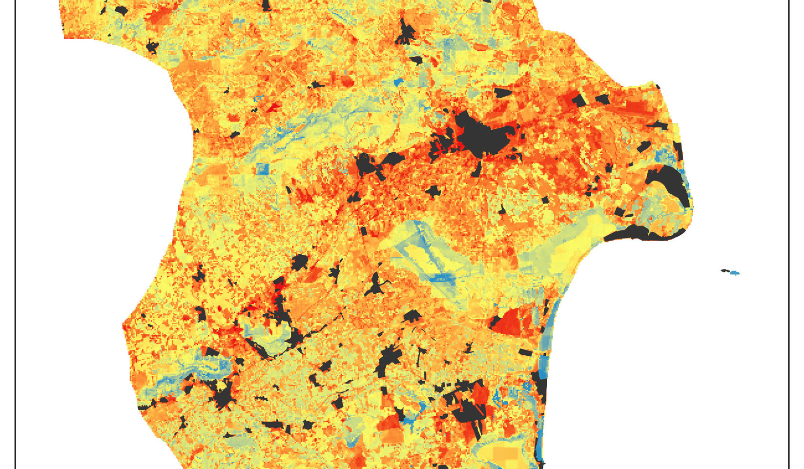
Later, stakeholders identified the main services provided by ecosystems present in each area and weighted them. As before, we used mapped information of these services or their indicators and multi-criteria models to draw integrated maps of the current provision of ecosystem services.
By using expert knowledge and the integrated provision of ecosystem services, we estimated the difference in the provision of ecosystem services between current and potential (reference) conditions, i.e. the potential gain in ecosystem services that could be delivered by ecological restoration. We also estimated the monetary costs of ecological restoration and then, the cost-effectiveness of ecological restoration actions.
An effectiveness analysis (by combining priority maps and cost) could identify areas with highest increases in the provision of ecosystem services at the lowest cost. And the adopted protocols allowed to invest in ecological restoration will fulfill society aspirations.
Maps will be used to collectively discuss restoration options, and promote and drive future investments from the public and the private sectors, and private-public cooperation.
Ecological Outcomes Achieved
Socio-Economic & Community Outcomes Achieved
Long-Term Management
The Regional Government (Generalitat Valenciana) has been involved in the project since its onset, and will adopt the tools and protocols derived from TERECOVA.
Sources and Amounts of Funding
The project has received funding from the Spanish Ministry of Economy, Industry and Competitiveness and European Regional Development Funds (FEDER) (CGL2014-52714-C2-1-R).
Other Resources
Link to the project website (in Spanish): www.recuperandonuestrospaisajes.org
Website includes a section called ‘Documentación” where reports and publications (also in English) are collected.
Related Research
The project has received students from different countries interested in developing master's degree final projects and others studies.Primary Contact
Name:
Jordi Cortina
Affiliation:
University of Alicante
City:
Alicante