Overview
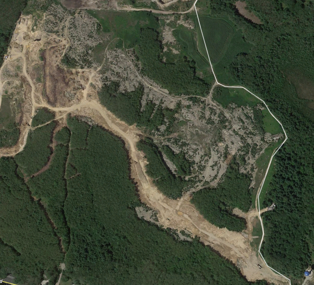
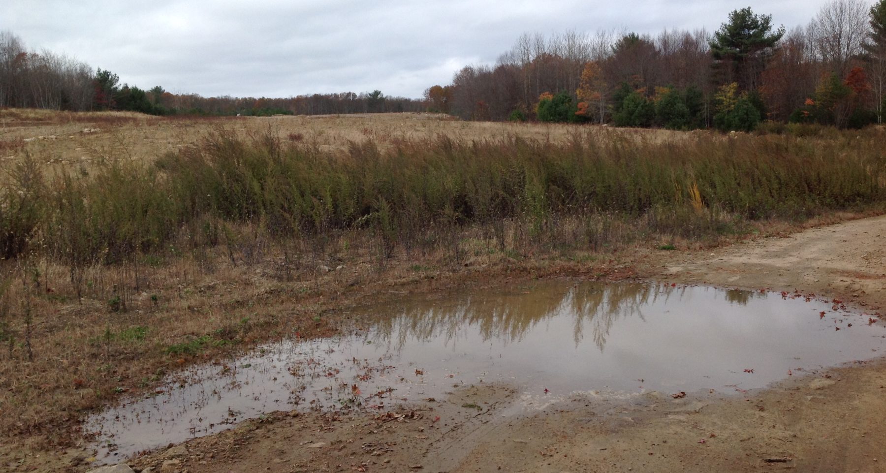
Country Acres Road- Richmond, Rhode Island, was once home to mixed temperate forest with seasonal freshwater wetlands. Now, the bulk of the 47 acres consists of heavily degraded sand and gravel pits. Since extraction has ceased, uneven topography invaded predominantly by Ambrosia artemisiifolia (Common Ragweed) remains.
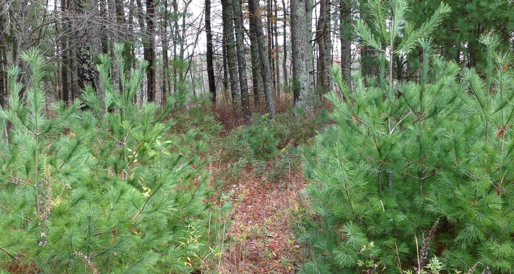
The existing forested wetlands are dominated by an Acer rubrum (Red Maple) canopy and a Clethra alnifolia (Coastal Pepperbush) shrub layer with invasive species including Microstegium vimineum (Japanese Stiltgrass) present.
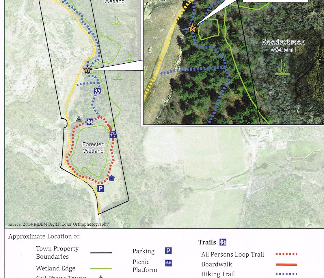
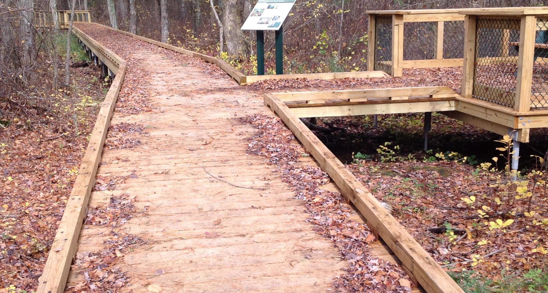
The project goal is to provide passive recreation for all persons. Educational plaques about the heritage and environmental history of Richmond are installed along the main trail. Wildflower seeding at the trailhead is taking place in late fall 2017 to establish wildlife habitat with aesthetic value. A wooden walkway and bridge were also erected in 2017 through the wetland portion of the trail, allowing wheelchair access.
The next phase of the project involves restoring the sand pits by installing nitrogen-fixing native plant material beneficial to migratory birds and insect pollinators. The remaining restoration will require ongoing management to eradicate persistent invasive species. An adjacent parcel of similarly degraded land is slated for commercial development but a restoration of native plant species on that property is not likely to occur.
Quick Facts
Project Location:
Country Acres Road, Richmond, RI, 41.4944764, -71.67083630000002
Geographic Region:
North America
Country or Territory:
United States of America
Biome:
Coastal/Marine, Freshwater, Temperate Forest
Ecosystem:
Freshwater Wetlands, Temperate Forest - Mixed, Other/Mixed
Area being restored:
19.0202 hectares
Project Lead:
Richmond Conservation Commision-Town of Richmond, Rhode Island
Organization Type:
Governmental Body
Project Partners:
The project was proposed and implemented by the Richmond Conservation Commission with the support of the Town of Richmond Department of Public Works. Other grant funding and in-kind services were provided by the Rhode Island Department of Environmental Management, The Rhode Island Foundation, Richmond Eagle Scout Troop #1 and many community volunteers including students from the University of Rhode Island. Project design was provided by CJ Doyle Engineering. Site survey services were provided by Dowdell Engineering and Alfred DiOrio RLS, Inc. Construction was done primarily by SumCo Eco-Contracting with assistance from the Richmond Department of Public Works.
Location
Project Stage:
Monitoring & Evaluation
Start Date:
2003-01
End Date:
Phase 1 2017-12, Phase 2 ongoing
Planning \ Design:
168
Implementation:
24
Post-Implementation Maintenance:
24
Monitoring & Evaluation:
12
Primary Causes of Degradation
Agriculture & Livestock, Fragmentation, Invasive Species (native or non-native pests, pathogens or plants), Mining & Resource ExtractionDegradation Description
Primary cause of degradation is attributed to mining of sand and gravel with resultant habitat fragmentation and presence of invasive species. Wetland area was impounded and ditched for agricultural use, probably cranberry farming during the 1700s and 1800s..
The project area is 85% degraded and soil fertility is extremely low after years of sand and gravel extraction/removal of topsoil and most of the existing vegetation. Topography consists of hills, pits and berms making access for mowing or removal of invasives with riding equipment extremely difficult.
Defining the Reference Ecosystem
The reference ecosystem is based on diverse sources of information (e.g. multiple extant reference sites, field indicators, historical records, predictive data).Reference Ecosystem Description
The reference ecosystem is based on historical records dating back to 1870 describing a privately owned hardwood forest with a dwelling. Information provided by the head of the Richmond Conservation Commission was invaluable in determining the history of the site. The forested swamp through which the boardwalk passes is an invaluable reference ecosystem as this portion of the site was undisturbed by mining operations. Glacial outwash deposits underlie much of the broad Meadowbrook wetland including the forested swampland which makes up approximately 10% of the site overall.
Soils are generally till: unstratified mix of sand, clay, silt and gravel supporting Oaks, Maples and Beech trees. Annual rainfall for this area totals 51.82″ on average with annual snowfall at 29.4″. High temperature averages 81° in July with low temperature averaging 19° in January.
The pre-disturbance condition of the ecosystem was temperate mixed deciduous and conifer forest with seasonal freshwater wooded wetlands.
Project Goals
The goal is to restore the non-forested formerly mined acreage to native grass and wildflower meadow incorporating woody plant material beneficial to wildlife; especially migrating birds and pollinators of all types. Adjustments made to account for the heavily degraded condition post-extractive activity will include installation of nitrogen-fixing plant material to improve soil condition and promote plant diversity. Native tree species will ultimately shade out some of the invasive Ambrosia artemisiifolia.
The land was acquired as part of the Town approval process for the adjacent Richmond Commons development. The Town seeks to provide passive recreation and exercise for residents as well as an important learning opportunity on the historic, cultural and ecological legacy of the town. The ultimate goal is to secure permanent access to adjoining lands so that a future trail connection will link the Heritage Trail at Meadowbrook wetland with the state’s North-South trail in the Acadia Wildlife Management Area, approximately 2 miles to the northwest. Another goal there is to relocate the North-South Trail from the heavy-traffic Route 138 to an off-road alignment for user safety and increased aesthetic values.
Monitoring
The project does not have a monitoring plan.
Stakeholders
The Citizens of the Town of Richmond are the primary stakeholders. All information relating to the project is available to the public at the Town Hall less than 1 mile from the site. There have been numerous articles online and in local publications promoting the opening of the trail, as well as calls for volunteers to local grade school and University students, scout groups and local residents. It is hoped that the trail will be incorporated into history and ecology lessons for students of the Richmond Elementary School which is within walking distance of the site.
In addition, the adjacent land is owned by a developer with plans to build a shopping mall and luxury housing units.
Description of Project Activities:
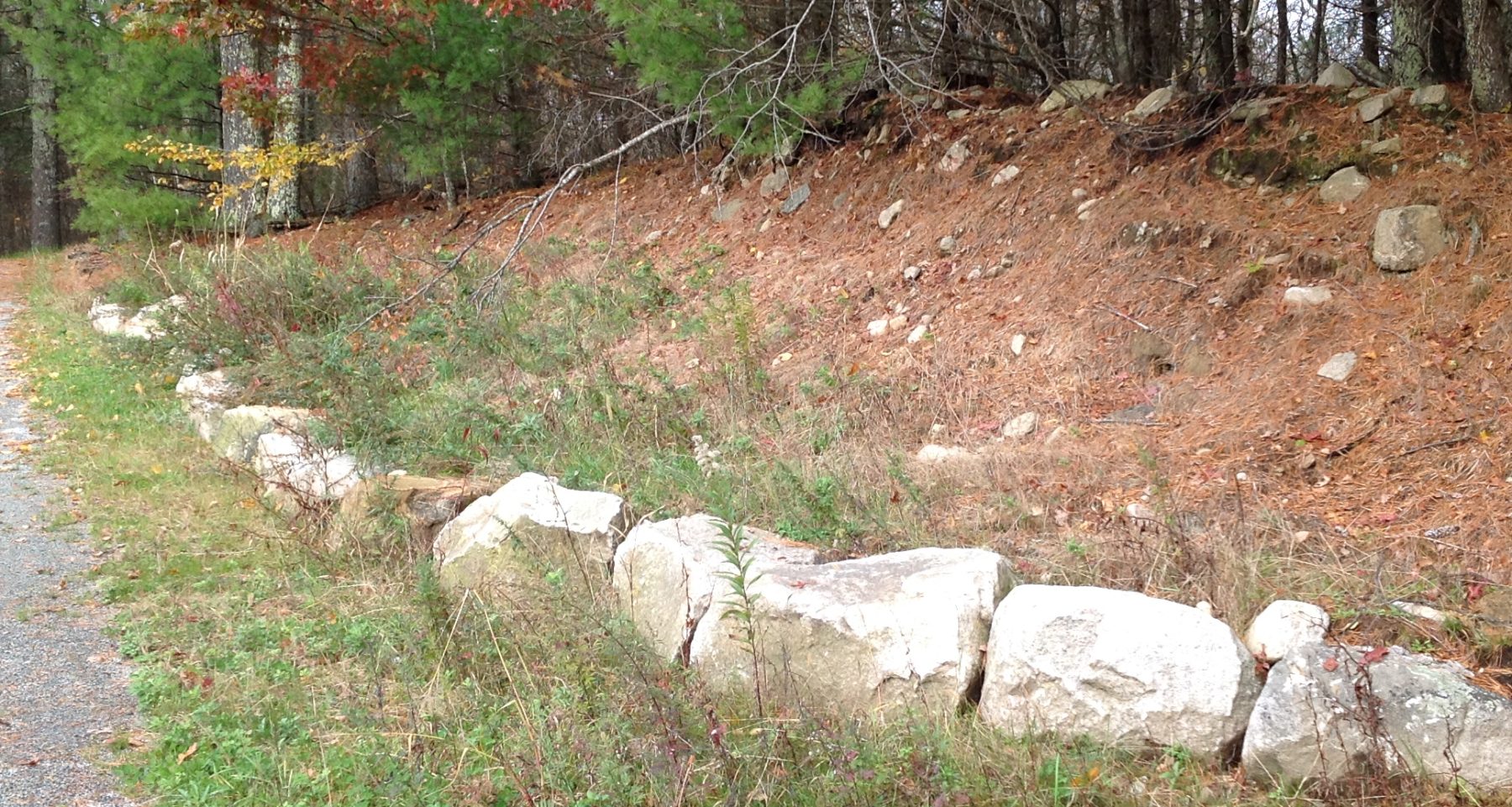
Degraded banks around wooded area were shored up with granite rock and boulders. (2)
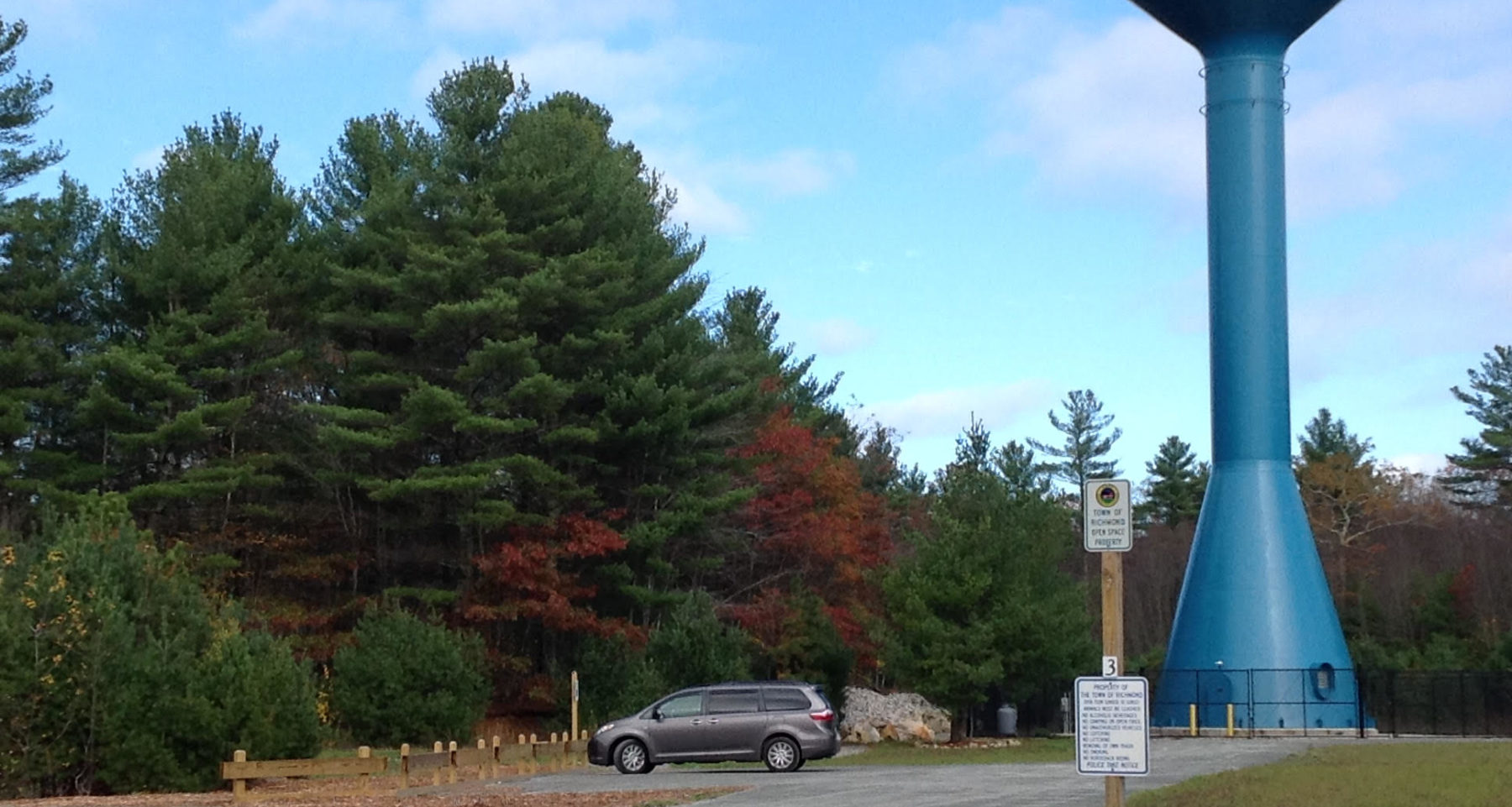
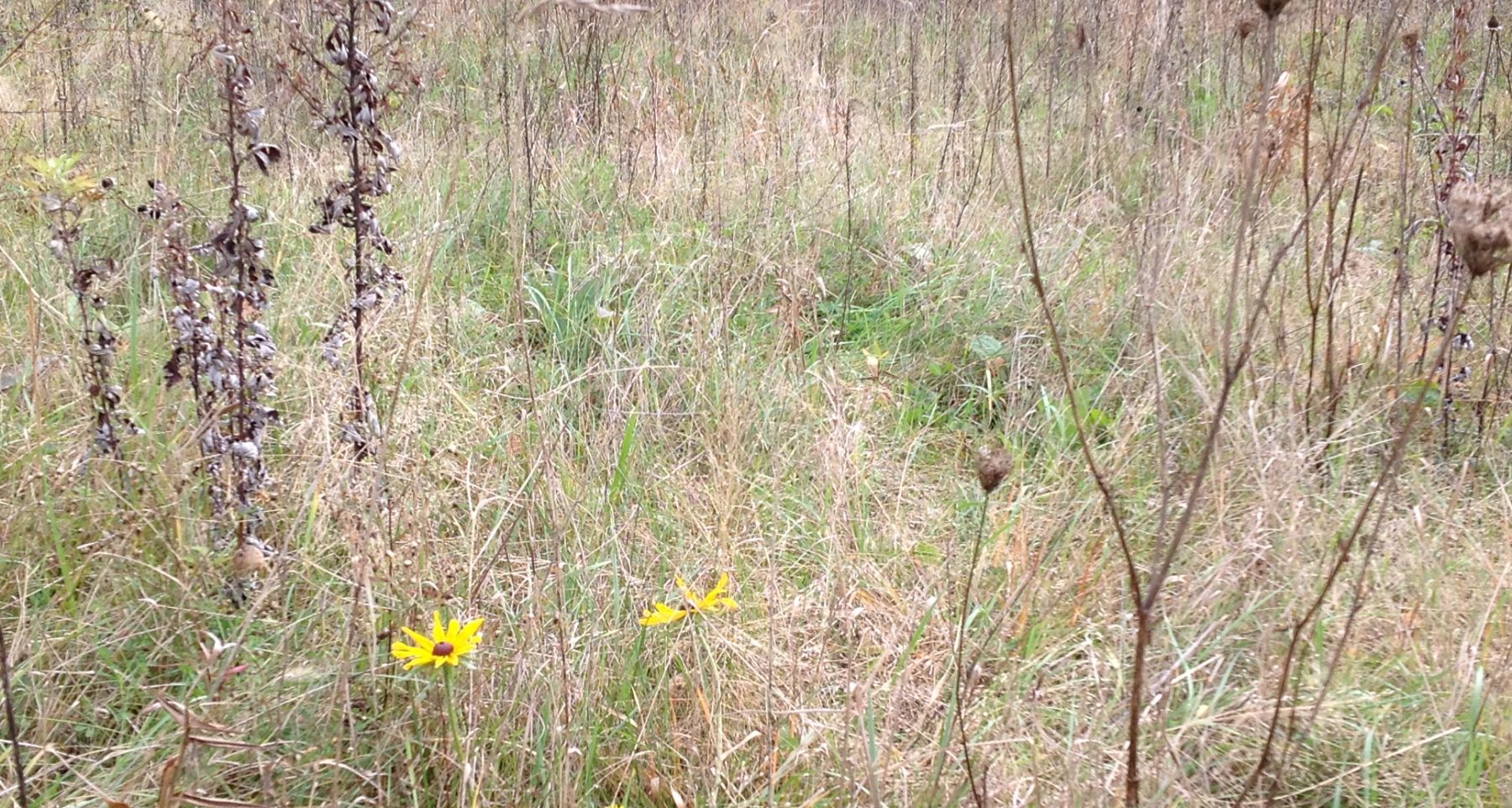
A blue-blazed hiking trail through the wooded area was delineated. Level paths of crushed bluestone were created to provide an ADA-compliant loop trail featuring a wooden bridge and picnic deck built over the wetland areas.(Socio-economic) Plaques with historic information and photos pertaining to Richmond history and environment are placed along the trails. At the trailhead, approximately 1 acre of degraded sand and gravel is in the process of being restored to open grassland and wildflower areas for pollinators and wildlife habitat as well as aesthetic value.(3, 4, 5) A parking lot with a wooden edge railing for five vehicles was built to include one designated handicapped vehicle space. Signage was added at the entrance to the parking lot describing rules for use. Signage along Route 138 at the Country Acres Road entrance is forthcoming.(Socio-economic factors)
How this project eliminated existing threats to the ecosystem:
Existing threats to the ecosystem in the form of invasive plants and unmanaged invasives on adjacent land have yet to be eliminated.
How this project reinstated appropriate physical conditions (e.g. hydrology, substrate)",:
Appropriate physical conditions have been partially reinstated with the shoring up of degraded banks.
How this project achieved a desirable species composition:
Desirable species composition partially achieved by overseeding with a variety of conservation wildflower seed mix over approximately one acre at the trailhead.
How this project reinstated structural diversity (e.g. strata, faunal food webs, spatial habitat diversity):
Reinstate structural diversity: very little to date ( see #3)
How this project recovered ecosystem functionality (e.g. nutrient cycling, plant-animal interactions, normal stressors):
Ecosystem functionality has yet to be recovered in 80% of the project area.
How this project reestablished external exchanges with the surrounding landscape (e.g. migration, gene flow, hydrology):
Re-establishment of external exchanges with the surrounding landscape is minimal in all but 20% of the project area.
Activities were undertaken to address any socio-economic aspects of the project:
Level paths of crushed bluestone were created to provide an ADA-compliant loop trail featuring a wooden bridge and picnic deck built over the wetland areas.
Ecological Outcomes Achieved
Eliminate existing threats to the ecosystem:
Extent of recovery to date is barely 10% overall.
Factors limiting recovery of the ecosystem:
Adjacent acreage remains heavily degraded with Ambrosia, an especially difficult plant to eradicate due to heavy seed bank remaining viable for 20 years. Commercial development of the adjacent area has yet to begin, so for now the Ambrosia remains. Common Annual ragweed is notoriously herbicide-resistant. Topography greatly limits access for mowing, mechanical scything or herbicide application. It is recommended that a combination of all three is necessary to control the Ambrosia.
Socio-Economic & Community Outcomes Achieved
Cultural dimensions such as recreational, aesthetic and/or spiritual:
There is now a one-half mile of ADA-compliant hiking trail open to the public. Hiking is possible throughout the 47 acres including an additional one mile of trail and gravel road connecting to the ADA compliant section. Beautifully executed, weatherproof plaques offer local cultural, historic and environmental information with easy-to-read color graphics and enlarged archival photographs.
Trails are open to all, including persons with leashed dogs, and bicycles. Although 75% of the restoration is undone, the existing blazed “blue trail” is also a very nice walk. The remaining half mile of gravel road, although rough, also provides a walking or bicycle trail.
Key Lessons Learned
Evaluation is ongoing. Seeding open areas with native annuals and perennials will gain momentum as time goes by and plant material is left to re-seed. Nitrogen-fixing plants and shrubs beneficial to songbirds and migrating birds need to be installed to shade out undesirable plants, improve the soil quality, and begin combating the persistent Ambrosia seed bank.
Regular maintenance mowing and or burning of Ambrosia areas needs to be implemented and maintained. There is a good opportunity here to use roadside brush cutting equipment to address the ragweed problem. Year-round maintenance of the ADA trail will be necessary to preserve access and reduce instances of washed out areas for example, that render the path impassable to wheelchairs or strollers.
Long-Term Management
A phased long-term restoration and management strategy is in the process of being developed with the hopes of obtaining more grant money to fund ongoing work. The 1.5 mile trail is functional and will be mostly self-sustaining. There are plans to weed out the Microstegium and replace it with Impatiens capensis. The method to restore this small bit of wetland is as yet unclear as the Impatiens seeds are difficult to germinate and take two years to do so. Other plant alternatives such as Carex are being explored. As far as the bulk of the restoration-the sand and gravel pits-the Ambrosia must be eradicated and to date the most logical and effective method would seem to be a controlled burn done by the town. Data review and search is being done on possibly planting nitrogen-fixing perennials such as clovers and Baptisia, as well as shrubs and trees beneficial to birds and other wildlife. This practice could begin to repair the degraded soil making it hospitable for more diverse vegetation. It is also hoped that newly installed trees may eventually shade out the ragweed. There is also the ongoing problem of the unmanaged acreage abutting this project that continues to be covered with Ambrosia.
Any long-term management plan at present is carried out primarily by volunteers from the Richmond Conservation Commission, the Town of Richmond.DPW and local residents.
Grants and ongoing funding sources are in the works.
Sources and Amounts of Funding
RI Dept of Environmental Management $ 97, 473 (2014)
RI Foundation $15,000 (2016).
Town of Richmond (including Richmond Conservation Commision) $ 240, 473 (2014-2016)
Volunteer Labor: RCC, Town staff, Richmond Eagle Scout Troop #1
University of RI Restoration Ecology students
Other Resources
Application No. 15-0185 RIDEM 10/14/2015
Town of Richmond, RI Richmond Conservation Commission Re: Approval of Contract Award for Richmond Heritage Trail construction 01/11/2017
Intellicast Richmond Historic Weather (02832) http://www.intellicast.com/Local/History.aspx?location=USRI9983
United States Department of the Interior Heritage Conservation and Recreation Service: National Register of Historic Places Inventory-Nomination Form. HILLSDALE HISTORIC AND ARCHEOLOGICAL DISTRICT Richmond, RI 009
Google Maps 41.5013729,-71.6657154 to Arcadia Management Area
Richmond Conservation Commission, RI: KEEP RICHMOND GREEN AND BEAUTIFUL
https://richmondconservationcommision.wordpress.com/
Trails and Walks in Rhode Island: Richmond Heritage Trail-Richmond 10/29/2017
https://trailsandwalksri.wordpress.com/category/richmond-ri/
University of Rhode Island: RI Native Plant Guide. 2017
https://web.uri.edu/rinativeplants/
Smith, S.B. and S.R. McWilliams. 2011.Recommended plantings for migratory songbird habitat management. Kingston, Rhode Island. Dept of Natural Resources Science, URI.
Summers, C. 2010. Designing Gardens With Flora of the American East.
http://www.audubon,org/magazine/january-february-2013/turn-your-yard-winter-refueling-spot
Buttenschon, R et al (2009) “Guidelines for the management of common ragweed, Ambrosia artemisiifolia” EUPHRESCO project AMBROSIA 2008-09
http://www.EUPHRESCO.org
Primary Contact
Name:
James Turek
Affiliation:
Richmond Conservation Commission
City:
Richmond
State:
Rhode Island
Organizational Contact
Name:
Karen Pinch
Affiliation:
Richmond, RI Town Administrator
City:
Richmond
State:
Rhode Island