Overview
The south-west of Western Australia is a global biodiversity hotspot where its high biodiversity suffers many threats. One of those threats is fragmentation of habitat owing to the large scale land clearing that was carried out in the 1950s and 1960s. This connectivity project aims to address this, and other threats, by restoring connections across a 70km swathe of farmland. Bush Heritage Australia has developed a Conservation Action Plan (using the Open Standards) in this area, where we are working to reconnect two large National Parks. The restoration of cleared farmland began with 60 hectares in 2003 and in 2018 a total of 2,500 hectares have been revegetated with varying levels of success. This project is focused on a 425-hectare restoration project on the Monjebup North property. The goal for this property was to reinstate as many species of native flora as possible, which in turn would provide habitat for the fauna known to inhabit the greater area. Plants were reinstated using both direct seeding and hand planting of seedlings over 4 years. Monitoring since 2012 has found that habitat structure is developing and many species of fauna have returned to the once cleared farmland.
Quick Facts
Project Location:
Monjebup WA, Australia, -34.2656066, 118.56742830000007
Geographic Region:
Australia & New Zealand
Country or Territory:
Australia
Biome:
Temperate Forest
Ecosystem:
Other/Mixed
Area being restored:
425 hectares
Project Lead:
Bush Heritage Australia
Organization Type:
NGO / Nonprofit Organization
Project Partners:
South Coast Natural Resource Management
Marlak Pty Ld
Threshold Environmental
Location
Project Stage:
Completed
Start Date:
2010-01
End Date:
2018-12
Primary Causes of Degradation
Agriculture & Livestock, FragmentationDegradation Description
The land was cleared of most of its native vegetation during the 1970s and 1980s, which was supported and encouraged by the State government of the time. The plant communities that were cleared included mallee heath and yate woodland. The land was growing cereal crops and sheep until 2012, which resulted in a severe loss of biodiversity, soil compaction, erosion and degradation of the soil profile as well as fragmentation of habitat between a large nature reserve and undisturbed bush land.
Defining the Reference Ecosystem
The reference ecosystem is based on diverse sources of information (e.g. multiple extant reference sites, field indicators, historical records, predictive data).Reference Ecosystem Description
The key attributes of the reference ecosystem used to evaluate restoration success included vegetation structure and cover, floristic diversity, soil attributes, bird activity and vertebrate fauna species richness. The reference system occurred adjacent to the restoration site and correlations were drawn between soil types and topography of the sites to enable 13 different vegetation systems to be identified for restoration on the property.
Project Goals
The project’s primary goals are to reinstate as many species of native flora as possible, which in turn will provide habitat for the fauna known to inhabit the greater area with the ultimate aim of reconnecting existing native bush land.
Monitoring
Monitoring Details:
Bush Heritage Australia is committed to long term monitoring of all the properties it manages across Australia. Monjebup is no exception and local staff are responsible for carrying out the monitoring, analysing the results and providing adaptive management. The Conservation Action Plan (developed using the Open Standards for Conservation) uses 8 indicators to monitor the success or otherwise of restoration on all properties, these are:
1. Extent of mallee heath community - Number of hectares restored
2. Plant genera establishment - Number of plant genera in restored areas/year
3. Stem density - Mean number of stems/hectare over all restoration monitoring sites/year
4. Presence of ground dwelling fauna - Species richness of ground dwelling fauna at restored and reference sites
5. Bird activity and species richness - Index of bird activity and species richness at restored and reference sites
6. Bat activity - Index of bat activity at restored and reference sites
7. Extent of wallaby habitat restored - Hectares of wallaby habitat restored based on wallaby monitoring
8. Presence/absence of wallabies at restored sites - Camera trap rate of wallabies at restored sites
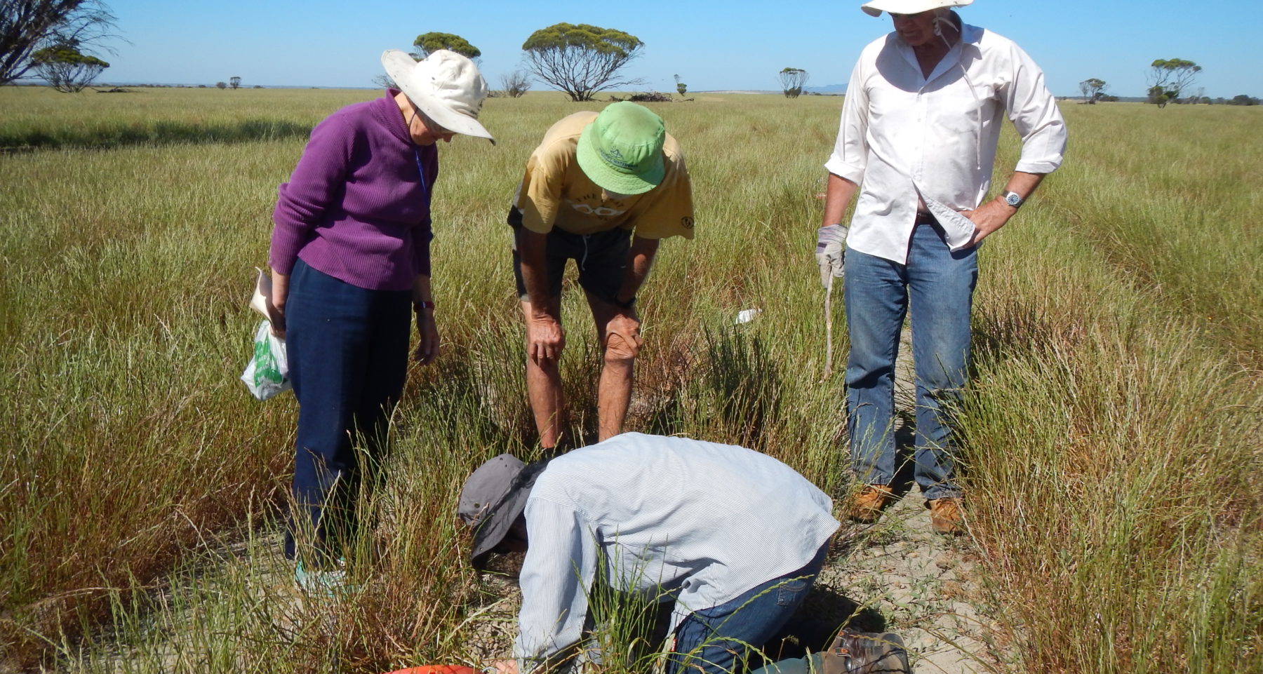
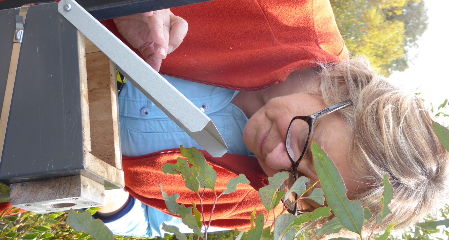
Monitoring of birds and other vertebrate fauna was carried out prior to revegetation of the property. This has been continued each year since 2012 and will continue annually into the future. Monitoring of germination and survivorship of direct seeding and seedling planting is carried out a few months after planting and then again annually. Artificial nest boxes for small marsupials have been installed and are monitored annually. Aerial drone monitoring has been trialled at the site.
Start date, including baseline data collection:
2011
End Date:
Will keep monitoring into the future as long as resources allow.
Stakeholders
The primary stakeholders in the project are local landholders, local government authorities, other conservation NGOs and Bush Heritage supporters. They were involved in the initial development of the Conservation Action Plan for the area and provided guidance for choosing the conservation targets, indicators and attributes of each target and monitoring methods. They are kept informed through newsletters, social media, Bush Heritage website and open days on the reserve.
How this project eliminated existing threats to the ecosystem:
All cropping and grazing activities were phased out after acquisition of the property between 2012 and 2014. The previous property owner was granted a lease over the cleared land and continued cropping and grazing up until a few months prior to direct seeding activities. The last crop over the final 100 hectares was harvested in late 2013. The continuation of cropping and grazing was essential on this property to allow any residual fertiliser to be taken out of the system prior to direct seeding (phosphorous in particular is toxic to many of our native plants). A further factor was weed control which, if not carried out, would allow weeds to become established thus making pre-seeding control more difficult and expensive. No further inputs of pesticide, fertiliser or soil disturbance occurred on this property after 2014. Herbicide was used when necessary to increase the survivorship of native germinants prior to planting during 2014-2018. No further herbicide use will be necessary after the end of 2018.
How this project reinstated appropriate physical conditions (e.g. hydrology, substrate)",:
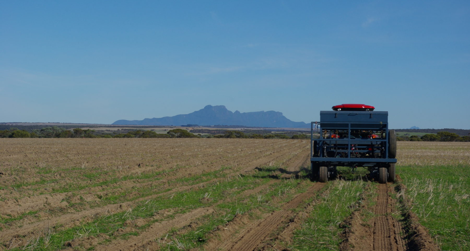
The process of direct seeding includes the formation of furrows that are created along contours to assist in water infiltration, or where water is used where it falls instead of running off. The site is reasonably level and the contour furrows are effective at preventing high energy run-off in high rain fall events, which occur regularly in this area.
How this project achieved a desirable species composition:
Planning for the restoration of the cleared land included an analysis of the soil, plant and fauna species of the reference sites. A restoration plan was prepared which included 13 vegetation systems on relevant soil types. Seed from around 150 native plant species was sown across the cleared area, which included species from each strata, species to provide a nectar supply year round, short-lived leguminous species to provide nitrogen fixing and coarse woody debris. Further hand planting of nodes of Proteaceous species has been carried out to enhance the availability of nectar for those fauna dependent on it.
How this project reinstated structural diversity (e.g. strata, faunal food webs, spatial habitat diversity):
Plant species representing all strata were included in the seed mix although the species included for the ground layer was much less diverse than the reference sites. The Restionaceae and Cyperaceae families, or 'sedges' are particularly challenging to reintroduce to our disturbed landscapes as are some of the geophytes and forbes. A special effort was made during this project to reinstate microhabitat for fauna. Coarse woody debris and rocks have been re-distributed to provide shelter to invertebrates (including termites), small marsupials, native rodents, reptiles and frogs and for foraging habitat for birds.
How this project recovered ecosystem functionality (e.g. nutrient cycling, plant-animal interactions, normal stressors):
Leguminous plant species were included to fix nitrogen in the depleted soils. Plants were also chosen to provide nesting material and habitat for birds and other vertebrates.
How this project reestablished external exchanges with the surrounding landscape (e.g. migration, gene flow, hydrology):
This project is based on the assumption that by physically reconnecting two large reserves of undisturbed native vegetation gene flow will be reestablished between plant and animal populations; nomadic and dispersal limited species will benefit and hydrology will return to pre-clearing regimes.
Activities were undertaken to address any socio-economic aspects of the project:
Bush Heritage engaged local contractors for tasks including weed control, site preparation, seed collecting, seedling supply, direct seeding operation, feral animal control and herbivore control. This policy ensures that the local community gains a benefit from the land being taken out of production and into conservation.
Ecological Outcomes Achieved
Eliminate existing threats to the ecosystem:
The threat of cropping and grazing has been eliminated from this property. The threat of fragmentation has been addressed by restoring native vegetation between two large areas of undisturbed native bush land.
Reinstate appropriate physical conditions",:
Since the cessation of farming the soil has been stabilised and is no longer subject to wind or water erosion, impaction or other disturbance from farming practices. The reinstated perennial vegetation system further protects the soil from erosion by providing soil binding roots, leaf litter and
protecting cryptogamic crusts.
Achieve a desirable species composition:
Results of monitoring has found that approximately 25% of reference site plant species occur in the restoration. This is a good result for this part of the world given the high plant diversity present in the reference sites and the paucity of knowledge on techniques needed to reinstate a majority of the species. The vertebrate fauna results are higher with around 68% of species known from the reference sites occurring in the restored sites. Feral predators are still present and research is ongoing regarding integrated feral predator control in fragmented landscapes on the south coast of Western Australia.
Reinstate structural diversity:
All strata are present, although the ground layer is less diverse in species than the reference sites. Habitat diversity is high with the provision of areas of native grasses, sparsely vegetated areas, dense thickets and nodes of Proteaceous plants for the wide variety of nectar feeding honeyeater birds and mammal pollinators that occur in the area.
Recover ecosystem functionality:
There is evidence of high productivity of the restored areas, particularly for some birds. The results of monitoring show that there is higher bird activity for some of the functional groups i.e. nectivorous resource nomads, when compared to the reference sites. The fast growing vegetation is providing a higher lever of resources at present than the older and, sometimes, senescent reference sites. Reproduction is occurring in the restored sites as evidenced by birds nesting, young marsupials in nest boxes, a high level invertebrate activity, flowering and seeding plants and recruitment of young plants.
Reestablish external exchanges with the surrounding landscape:
The evidence for gene flow has not been established yet for this project. Research is being carried out currently on the genetics of five plants species with the aim of improving planning of future restoration activities and the adaptive management of already established restoration sites by addressing a significant knowledge gap in the field of restoration ecology; that of how ecological and genetic viability of restored plant populations is affected by different establishment regimes and over time.
Factors limiting recovery of the ecosystem:
The presence of feral predators, such as the European Red Fox and Feral Cat are quite likely limiting the re-colonisation by some native fauna species. There has been some plant death that has been attributed to either dry summer condition or wet winter condition.
Socio-Economic & Community Outcomes Achieved
Economic vitality and local livelihoods:
The project has contributed in a small way to the livelihoods of those in the local community who have been engaged to control weeds, herbivores and feral predators, to conduct site preparation, seed collecting and direct seeding programmes.
Key Lessons Learned
The key lessons learned by this project include:
- Plantings that are too dense don’t thrive,
- We have a lot more to learn about propagation, germination and seed treatment of our Australian native plant species, and
- Our native fauna responds quickly to the provision of suitable habitat.
Our monitoring shows that plantings that achieve over 15,000 stems per hectare don’t thrive as well as those that establish at a lower stem density. An exact stem density is difficult to achieve as germination is dependent on many factors and revegetation specialists can overcompensate for possible vagaries in weather. Dense germination results in high competition for soil moisture and light, it appears to also favour a high incidence of insect attack and disease. We are working with our contract revegetation specialists to ensure a results of <15,000 and >3,000 stems per hectare for future restoration projects.
Of the 590 plant species known to occur on the property only around 150 species were included in the restoration owing to a lack of knowledge of how to collect and treat their seed, germinate and/or propagate them. More research is required in this area to enable us to include a higher number of species in our restoration. A priority knowledge gap where research effort is being sought is the re-establishment of Restinaceae and Cyperceae species.
Australian native fauna have returned to the restored area sooner than predicted and we now need to examine in further detail the habitat requirements that are being exploited by each species and how we can improve or duplicate this in different vegetation systems.
Long-Term Management
The results from monitoring all the indicators are stored in Miradi software and are used to track progress and to provide adaptive management recommendations, i.e. fine-leaved eucalypts should be incorporated into all restoration for the use of pygmy possums for nesting material.
Sources and Amounts of Funding
Various funding sources have been utilised including philanthropic donations, state and federal government funding and industry sponsorship. The total amount invested in the restoration of 425 hectares of farmland is around $850,000AUS or $2,000AUS per hectare.
Related Research
This project forms part of a large research project that aims to : 1. Compare genetic (genetic diversity, mating system, pollen mediated gene dispersal) and ecological function (reproductive output) within restored populations in relation to surrounding undisturbed remnant vegetation 2. Determine how the ecological and genetic viability of restored populations progresses in restoration sites with different establishment regimes 3. Determine how the ecological and genetic viability of restored populations progresses in restoration sites of different ages. The results of this research are not yet available.Primary Contact
Name:
Angela Sanders
Affiliation:
Bush Heritage Australia
City:
Albany
State:
WA