Overview
The primary objective of this partner-based project is to begin a process that assists private landowners within the municipal district of Monchique, Algarve Region, Portugal, affected by the wildfire of 2018. As most landowners have small-holdings, the project-based process required to access financial support is onerous and in many instances linked to reforestation legislation.
The one-year project is funded by the Ryanair passengers Carbon Offset Fund. Based on ecological restoration principles, the restoration process focuses on the recovery of agriculturally important endemic and naturalized species in the first instance (Quercus suber, Arbutus unedo, Castanea sativa) as well as threatened endemic species (e.g. Quercus canariensis). In combination with the ‘planting´, land degradation (under SDG 15 and SDG 13) is being assessed via a PhD study on the link between land degradation, land-use typologies, climate change and future demands for ecosystem services. The long-term aim of this study (based on available funds) is to install an ecological restoration process linked to the participation of landowners for the restoration of the Natura 2000 habitats affected by wildfires in this area.
From a socio-ecological perspective, ecosystem resilience is being researched along with the socio-economic vulnerability of rural livelihoods affected by land degradation.
Quick Facts
Geographic Region:
Europe
Country or Territory:
Portugal
Biome:
Desert/Arid Land
Ecosystem:
Temperate Forest - Mixed
Area being restored:
The area being restored is a combination of a number of privately-owned properties.
Project Lead:
GEOTA
Organization Type:
NGO / Nonprofit Organization
Project Partners:
GEOTA (a national environmental NGO)
Ryanair - passengers 'Carbon Offset Fund'
The Algarve Directorate for Tourism
The Algarve office of the Institute for Nature Conservation and Forests (ICNF)
Monchique Municipality
Recover fire-damaged and degraded sites
- A1: Assess degraded ecosystems
- A2: Identify/prioritize locations for meeting national contributions to Aichi Targets
- A3: Involve all relevant stakeholders
- A4: Assess the costs/benefits of ecosystem restoration
- A5: Assess institutional, policy, and legal frameworks & identify financial/technical resources
- A6: Identify options to reduce the drivers biodiversity loss and ecosystem degradation
- B1: Review, improve or establish legal, policy and financial frameworks for restoration
- B4: Review, improve or establish terrestrial and marine spatial planning processes
- B5: Consider the need for safeguard measures
- B6: Review, improve or establish targets, policies and strategies for ecosystem restoration
- B8: Promote economic and financial incentives
- B10: Promote and support capacity-building, training, and technology transfer
- C1: Identify appropriate measures for conducting ecosystem restoration
- C2: Consider how restoration can support sustainability of agriculture/production
- C3: Develop ecosystem restoration plans with clear/measurable objectives and goals
- C4: Develop explicit implementation tasks, schedules, and budgets
- C5: Implement the measures
- D1: Assess the efficacy and effects of implementing the ecosystem restoration plan
- D2: Adjust plans, expectations, procedures, and monitoring through adaptive management
- D3: Share lessons learned from planning, financing, implementing and monitoring ecosystem restoration plans
Project Stage:
Implementation
Start Date:
2019-03
End Date:
2020-04
Primary Causes of Degradation
Agriculture & Livestock, Deforestation, Fire & Weather Events, Fragmentation, Invasive Species (native or non-native pests, pathogens or plants), OtherDegradation Description
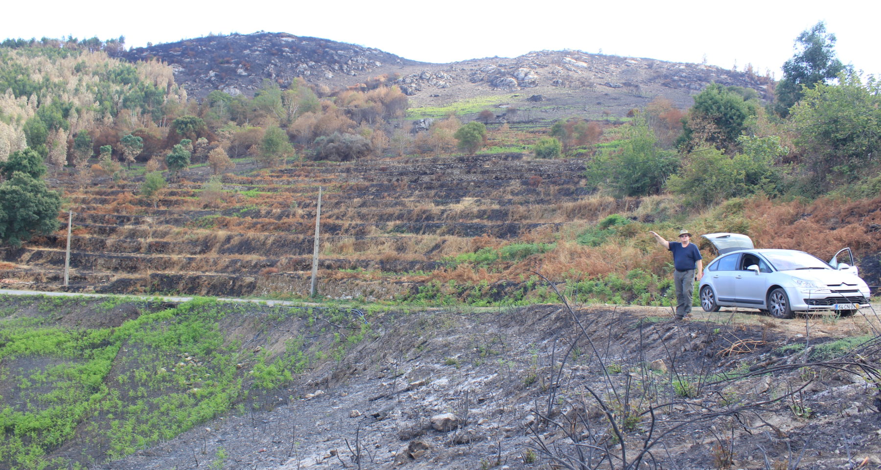
As the Renature Monchique project (like many ‘reforestation’ projects) is only funded for 1 year, a PhD study* has been set-up to research the historical and long-term aspects of land degradation within this area. The focus of this study is on the Seixe River Basin, a large part of which is included in the Renature Monchique project (see: TerraSeixe Project) and which was affected by the 2018 wildfire. The purpose of the PhD study is to determine the degree of degradation and the effect of land-use typologies on ecosystem structure and functioning and impacts on local biodiversity. Included in this study are issues related to landscape-scale impacts, such as fragmentation, the linkage between land-uses and the water cycle as well as the effect on future ecosystem services under the current scenario taking into account climate change.
As mentioned above, the socio-ecological and socio-economic/political aspects of land degradation will be assessed under the PhD study. This study aims to include a monitoring and evaluation plan (Aftercare) for the activities conducted under the Renature Monchique, which aims to plant around 75,000 trees. Land (soil) rehabilitation also forms part of the field-work to be conducted under the PhD – again, depending on available funding for this activity.
*Contact Justin Roborg-Söndergaard ([email protected]).
Defining the Reference Ecosystem
The reference ecosystem is based on diverse sources of information (e.g. multiple extant reference sites, field indicators, historical records, predictive data).Reference Ecosystem Description
A primary key attribute relating to this project is that it is in a Natura 2000 classified area.
Benchmarks for determining restoration success still need to be assessed and analysed – other than remotely sensed data there is very little available field-based data on the degree of land degradation and soil erosion affecting the Renature Monchique project sites or, for that matter, the Seixe River Basin. The PhD study aims to rectify this situation, providing a baseline using remote-sensing and field-based data to determine benchmarks for assessing the progress (success) of the interventions under the Renature Monchique project and the possibility of future ecological restoration actions in this area.
The rationale for determining the reference system(s) is based on the Natura 2000 habitats descriptions (desk-based), available historical records (literature and interviews with local landowners), observations of existing (intact) ecosystems, new data (based on site analysis – SWOT-C/Wheel) and other information that may be available, such as the recent baseline studies done under the TerraSeixe project.
Project Goals
The Renature Monchique´s primary goal is ‘carbon offsetting’ via tree planting. Although planned and designed as an ecological restoration project, the goal this project must first fulfill is established by this parameter and a metric based on the number of trees planted.
From an a socio-economic perspective, although planned and designed as an ecological restoration project (i.e. focused on ecosystems) as opposed to a reforestation project (i.e. focused on trees), the approach taken is to first recover agriculture-based areas that use endemic/naturalized species, such as ‘sobreirals’ for cork oak production by planting Quercus suber, ‘medronheirals’ for beverage and fruit production by planting Arbutus unedo and chestnut tree groves for ‘castenheiro’ (chestnut) production by planting Castanea sativa. Linked with this process is the ecological approach that aims to recover endemic/endangered tree species (as components of ecosystems) via the conversion of existing eucalyptus plantations and via riparian recovery (all river systems are inundated with eucalyptus and invasive species, such as Acacia spp.).
Monitoring
Monitoring Details:
The Aftercare programme was written into the original project plan - however, this aspect of the project is reliant on further funds for the Renature Monchique project (March 2019-April 2020) beyond April 2020 and the possibility of funds for the PhD study which will manage this process, both under a project extension and as part of the PhD study.
Start date, including baseline data collection:
This plan will begin in January 2020 under the Renature Monchique project - assessing the success of the planting regime which started in November 2019 (after the first rains). Baseline data collection started when the field work on the project commenced, i.e. October 2019.
End Date:
Not yet applicable - the project is ongoing.
Stakeholders
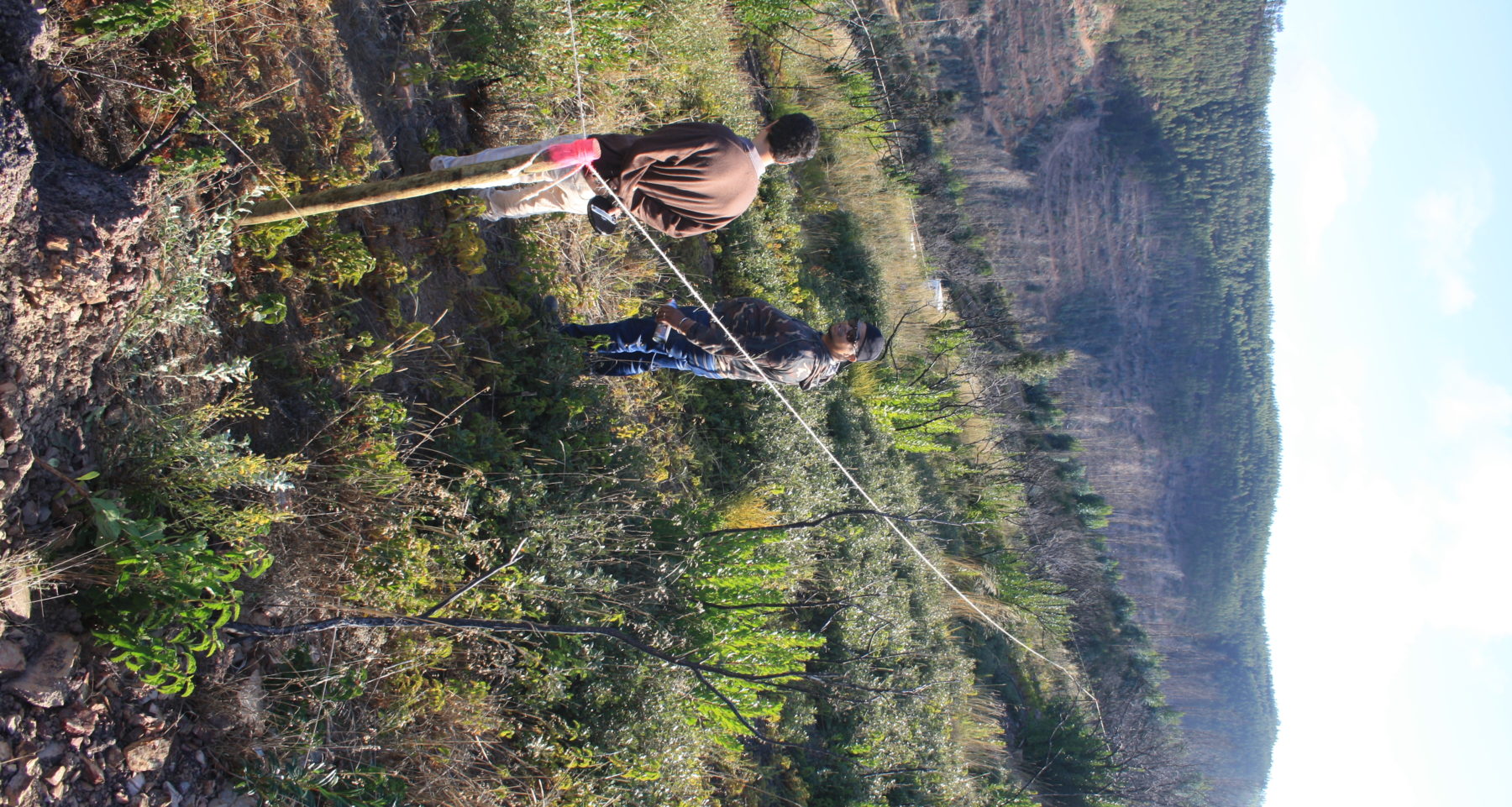
The primary stakeholders are the landowners. Landowners were included via a communication process that involved advertising the project, letters and telephone calls. The latter 2 actions were supported by the municipality of Monchique, while the former is being coordinated by GEOTA via a public relations initiative using Facebook and a web-series relating to the project.
The involvement of landowners is participatory – 1st based on interviews, 2nd on an agreement for a restoration design that addresses their needs, concerns and interests, and 3rd on an agreement for the work to begin. Communication with landowners is direct, i.e. the project management visit them regularly on their land. Also, the landowners have been included in the public relations initiative for the project under the auspices of GEOTA. Currently, apart from the direct contact with landowners which involves discussing the interventions and basis for these interventions, there is no education or outreach programme (funding and the project goal restricted this possibility). However, a proposal has been submitted for this type of programme to be included in the possible continuation of the project, i.e. beyond April 2020. GEOTA will also apply for national/regional funding to support this type of programme beyond April 2020.
How this project eliminated existing threats to the ecosystem:
Each site has been and is being assessed for threats such as soil erosion/over-utilization, invasive species and biodiversity. Almost every site requires conversion from eucalyptus to endemic species and the removal of invasive species, such as Acacia spp., along with a planned intervention to increase biodiversity through the assessment of vegetation communities. As the fire of 32018 destroyed most of these communities,
How this project reinstated appropriate physical conditions (e.g. hydrology, substrate)",:
The planning and design processes included a focus on the intimate link between land-uses (decision-based) and the water cycle. Recovery of the hydrological systems (water-lines, streams and rivers) was included in the original plan. While the design took into account water flows (run-off) and the effects of this owing to a lack of vegetation (a result of the fire), slope steepness and soil type as well as appropriate interventions to encourage water infiltration.
Substrate (physical and chemical) where needed is being added as part of the planting process to support soil water retention and plant growth.
How this project achieved a desirable species composition:
The primary aim is to first recover the socio-economic aspects of the intervention affected by the fires. This is to be achieved by using ecological recovery techniques, i.e. by increasing the number of commercially-viable endemic species. This means recovering areas of agricultural importance such as oak (sobreiral), strawberry (medronheiral) and chestnut tree groves.
Second to this process is the recovery of other endemic and threatened species such as Quercus canariensis in the first instance (access to seed and seedlings for these species is very difficult and must be planned well in advance - the project only started in March 2020 and is only planned for 1 year). For this purpose, GEOTA has formed an alliance with the Évora University who have a LIFE project focused on this aspect, i.e. the recovery/restoration of endemic species including Quercus canariensis and Rhododendron ponticum baeticum, both endemic to this area.
Invasive species are being appropriately controlled and removed where possible.
How this project reinstated structural diversity (e.g. strata, faunal food webs, spatial habitat diversity):
This process relates directly to the state of degradation regarding the sites where restoration actions are taking place. These sites have been badly affected and currently display low biodiversity, i.e. a handful of species that have been able to regenerate after the fire. The possibility of reinstating structural diversity in 1 year is daunting. Therefore, this aspect of the project is entirely reliant on the possibility that funding will be extended beyond April 2020. Despite this requirement, the PhD study will be carried out should there be an extension of funds or not. If not, this phase will be incorporated into the PhD study based as experimental actions based on ecological restoration principles.
How this project recovered ecosystem functionality (e.g. nutrient cycling, plant-animal interactions, normal stressors):
Reliant on the extension of funds and the PhD study.
How this project reestablished external exchanges with the surrounding landscape (e.g. migration, gene flow, hydrology):
Reliant on the extension of funds and the PhD study.
Activities were undertaken to address any socio-economic aspects of the project:
The activities undertaken are to first address the socio-economic needs, concerns and interests of the landowners, also considering possible future climate change effects, as part of the process to ecologically restore endemic species and develop ecosystem structure based on a reference system(s).
Ecological Outcomes Achieved
Eliminate existing threats to the ecosystem:
This process is ongoing and will involve actions over the long-term owing to the advanced state of invasion, particularly in the river systems.
Reinstate appropriate physical conditions",:
As the project groundwork only began in October 2019 and is ongoing, there is no supporting data to report on this aspect as yet.
Achieve a desirable species composition:
As the project groundwork only began in October 2019 and is ongoing, there is no supporting data to report on this aspect as yet.
Reinstate structural diversity:
As the project groundwork only began in October 2019 and is ongoing, there is no supporting data to report on this aspect as yet.
Recover ecosystem functionality:
As the project groundwork only began in October 2019 and is ongoing, there is no supporting data to report on this aspect as yet.
Reestablish external exchanges with the surrounding landscape:
As the project groundwork only began in October 2019 and is ongoing, there is no supporting data to report on this aspect as yet.
Factors limiting recovery of the ecosystem:
A number of factors have been identified. These include ecological, social and economic factors, such as the state of degradation (ecological) and the need to rapidly recover endemic-based tree agricultural tree systems (social and economic). Although supportive, the social-economic aspects of the project limit the ability to increase the number of non-commercial species in the first instance.
Socio-Economic & Community Outcomes Achieved
Economic vitality and local livelihoods:
By recovering the endemic-based commercially-viable tree systems, the aim is to assist landowners whose livelihoods rely on these species.
Provision of basic necessities such as food, water, timber, fiber, fuel, etc.:
The recover of the tree systems, as noted above, and the removal of dead trees from the fire allows landowners access to timber/fuel-wood. In many instances, not all of the eucalyptus present is being removed, but reduced to manageable sites for timber harvesting and honey production. The recovery of the endemic tree systems should revitalize the water flows as well as support the need for certain food types, such as chestnuts.
Cultural dimensions such as recreational, aesthetic and/or spiritual:
The process of recovery will take time. So recreational, aesthetic and spiritual values as cultural ecosystem services will be restored over time as these are dependent on the continuation of the restoration activities.
Regulation of climate, floods, disease, erosion, water quality, etc.:
As above, the recovery of regulating services will be over time and dependent on the continuation of the restoration activities.
Has the project had any negative consequences for surrounding communities or given rise to new socio-economic or political challenges?:
The political challenge is to change the mindset of landowners, local council planners and policy-makers as the paradigm for restoring damaged or degraded sites remains firmly entrenched in forestry-based (silvicultural) processes. The PhD study is investigating these processes based on a recent practitioner assessment. Nunes et al. (2016)* claim that "Restoration efforts in the Mediterranean Basin have been changing from a silvicultural to an ecological restoration approach. Yet, to what extent the projects are guided by ecological restoration principles remains largely unknown
*Reference - Nunes, A. et al. (2016) Ecological restoration across the Mediterranean Basin as viewed by practitioners. Science of the Total Environment 566–567: 722–732.
Key Lessons Learned
Nothing yet.
Long-Term Management
The plan in the first instance is to secure funding for these actions which it is envisaged will be the responsibility of GEOTA in cooperation with Nova University and other universities along with landowners, local associations and institutional partners who can provide support for these activities.
Sources and Amounts of Funding
Funding is private/corporate from Ryanair´s ‘Carbon Offset Fund’.
Other entities providing support – not funding – are the municipality of Monchique (strategic support), the ICNF (legal and the provision of plants at competitive prices) and universities (research based).
The project cost is 250,000 euros over the period March 2019 to April 2020. This means the effective cost per hectare, based on ICNF parameters for reforestation*, is around a 1,000 euros per hectare (in the first instance) considering the intervention is over 250 ha´s consisting mostly of non-contiguous land-plots.
Other Resources
The web-series (see: GEOTA Facebook <https://www.facebook.com/GEOTAmbiente/>) provides relevant information for the project to date. Further information will be provided once data for research purposes has been analysed.
Related Research
The project is currently being incorporated into a PhD study (Nova University) on land degradation in this region. Furthermore, GEOTA has created alliances/partnerships with Algarve University, Lisbon University and Évora University for research purposes.Primary Contact
Name:
Justin Roborg-Söndergaard
Affiliation:
GEOTA/Project consultant - PhD/Nova University of Lisbon
City:
Lisbon