Overview
The Yariguíes ridge, which reaches an elevation of 3200m and forms part of the central Andes range in the department of Santander, is a transitional climatic zone and includes oak-dominated forest, moist forest and Páramo habitats. Whereas the southern portion of the Yariguíes range was declared a national park in 2005, protecting more than 70,000 ha of the large watershed, the northern half has remained vulnerable to exploitation and is the principal source of water for Zapatoca, San Vicente, Betulia and other regional towns. Extensive conversion of forested habitat to pasture has impacted the northern portion of this catchment basin, and steep slopes have resulted in heavy erosion and loss of topsoil. We are in the process of restoring 30-35 ha of degraded habitat by planting patches of trees or regeneration nuclei. This method provides several advantages over traditional plantation-style planting: 1) it mimics the natural form of forest recovery, creating more habitat heterogeneity; 2) areas in between forested patches will recover passively and can provide space for enrichment planting of later successional species once a canopy cover has formed; and 3) a considerably larger area can be reforested using this method, reducing the cost of restoration/hectare.
Quick Facts
Project Location:
Yariguíes Ridge, 6.3333333, -73.5
Geographic Region:
Latin America
Country or Territory:
Colombia
Biome:
Tropical Forest
Ecosystem:
Tropical Forest - Seasonal Broadleaf
Area being restored:
30 ha
Project Lead:
Fundacion ProZapatoca
Organization Type:
NGO / Nonprofit Organization
Project Partners:
A discussion forum on “Ecosystem Conservation and Restoration" within the Ecology and Wildlife Conservation Group of the National University of Colombia in Medellín, Natural Reserves of the Civil Society Network
Location
Project Stage:
Monitoring & Evaluation
Start Date:
2016-10
End Date:
2017-09
Primary Causes of Degradation
Agriculture & Livestock, Deforestation, Fragmentation, Invasive Species (native or non-native pests, pathogens or plants)Degradation Description
Most degradation in this region is the result of conversion of forested habitat to pasture. Denuded steep slopes coupled with long-term intensive usage for cattle ranching have resulted in heavy erosion and loss of topsoil, which has reduced land productivity and impacted the catchment basin. The reduced volume of water produced by the watershed, coupled with the increased demand placed on limited water resources by cattle ranching and pig farming, have resulted in water shortages and concern for worsening conditions in the future. The municipalities of several towns in the area are concerned and are taking proactive measures to prevent further deforestation in the region. In addition to watershed concerns, local harvesting of hardwoods such as oak and other important economic species such as the wax palm Ceroxylon quindiuense (Arecaceae) have degraded a number of the remaining forest patches in the region. The northern Yariguies range is home to the Spectacled bear (Tremarctos ornatus), an emblematic species that is categorized as vulnerable by the IUCN due to habitat loss throughout its native range. Evidence of the presence of this species within the protected area is widespread and include markings on tree trunks, remains from consumption of bromeliads in many parts of the forest, and scat. An increase in the habitat provided for this species will not only protect but also help increase the population of the species.
Defining the Reference Ecosystem
The reference ecosystem is based on diverse sources of information (e.g. multiple extant reference sites, field indicators, historical records, predictive data).Reference Ecosystem Description
The Yariguíes plateau is part of the western foothills of the eastern range of the Colombian Andes. Given the transitional climatic range and broad range in elevation, this region exhibits extraordinary biotic wealth, which include many endemic and endangered species. It harbors oak forests (Quercus humboldtii Bonpl.), that are characterized by high species richness and also holds the distinction of being the northernmost range for Ceroxylon quindiuense (Arecaceae) the tallest palm in the world, and the emblematic national tree of Colombia. Only 50-60 individuals of this species remain in this area. The oak forest patches that remain in this northern watershed will serve as the reference forest for this study. Three 20×20 m permanent plots were established in three representative patches of forest in 2014 and all trees >10 cm DBH have been identified and censused. In addition, comprehensive inventories of the flora of the entire watershed have been carried out by Daniel Diaz MSc, a botanist who is collaborating on this project. Voucher specimens were collected and deposited at the herbarium in the Universidad Nacional de Colombia (Medellín). A monograph of all species censused is forthcoming and will be used to aid in determinations of new recruits in restored habitats. Restored plots will also be compared directly to reference forest plots to evaluate the efficacy of this methodology.
Project Goals
- Evaluate functionality of applied nucleation for restoration of seasonal tropical forest habitat.
- Assist in restoring forest cover to watersheds in the Yariguíes plateau that serve as key water sources for several regional towns.
- Evaluate vegetative establishment ability of a number of species.
- Expand potential habitat range for Ceroxylon quindiuense and other key species.
- Increase habitat area for Tremarctos ornatus.
- Engage broader community in project’s long-term goals and increase awareness on value of restoring forest habitat.
- Provide valuable field experience to dozens of undergraduate students from the Universidad Nacional de Colombia and regional Universities.
Monitoring
Monitoring Details:
We tagged and measured basal diameter of all individuals immediately after planting. Thereafter, survival and growth of stakes has been monitored every 6 months with visits by undergraduate students from the National University of Colombia (accompanied by one of the senior researchers). The survival of stakes with resprouting of the majority of individuals within the first 6 months were not as high as expected, but the monitoring continues. We anticipate canopy closure within 2 years of planting (Zahawi 2005). In addition to baseline monitoring of stakes additional long-term projects where planned including an examination of seed dispersal to plots (by means of seed traps), natural seedling recruitment, and enrichment planting of seedling in the understory of nuclei and alongside them, are all potential future projects for MS or PhD students from the National University of Colombia in Medellín or another regional University.
Start date, including baseline data collection:
We started working on the baseline at least five years ago (2013)
End Date:
We hope to continue working in the area for an indefinite term
Stakeholders
Out of a concern for the progressive deterioration of this habitat, a number of local residents began to purchase key properties to insure their long-term protection and allow for habitat recovery. This regional protected area now covers the entire northern Páramo plateau and upper watersheds, which is the spring source for many of the creeks that emerge at lower elevations. All told, >500 ha are now protected, forming a private network of reserves that have been formally approved by the government under the 1996 Protected Areas National System (SINAP) private reserve act. There are now three officially registered reserves as well as a number of other properties that are under consideration. Registered reserves are: El Páramo-La Floresta (RNSC 056-13), La Montaña Mágica-El Poleo (RNSC 080-15), and Traganubes (RNSC 083-15). Finally, several municipalities have voiced strong support for the protection of these watersheds and are actively participating through various supportive measures.
How this project eliminated existing threats to the ecosystem:
The process of acquiring the properties of the reserves began more than five years ago. Since then the cattle was removed (main degradation factor) and nature began to do its work.
How this project achieved a desirable species composition:
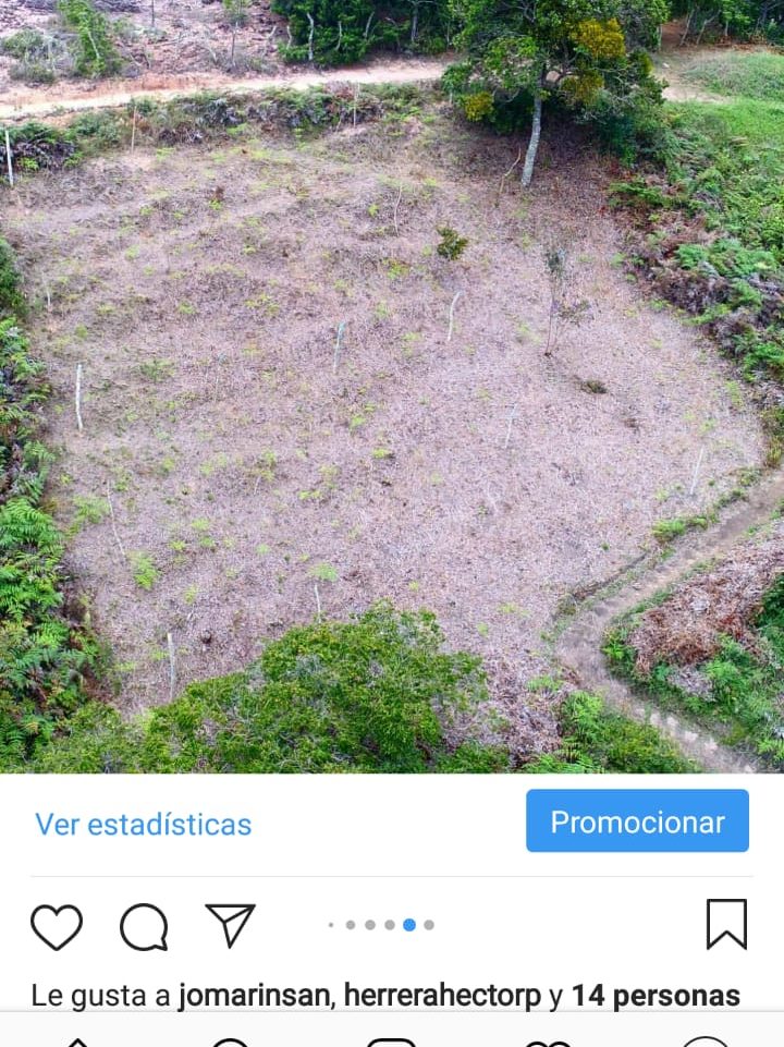
We planted 36 individual trees/nuclei, each 15x15 m in size using 9 species (n=4 individuals/species/nuclei). Approximately 8-9 nuclei will be planted per hectare, covering ~20%/ha. Nuclei density was dictated in part by topography and the presence of patches of forest and other landscape considerations. Although only ~6 ha was planted, in all we reforested ~30-35 hectares of degraded habitat using this methodology.
How this project reinstated structural diversity (e.g. strata, faunal food webs, spatial habitat diversity):
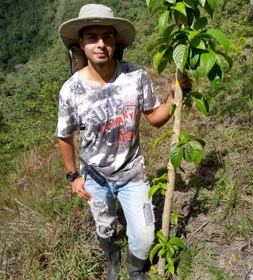
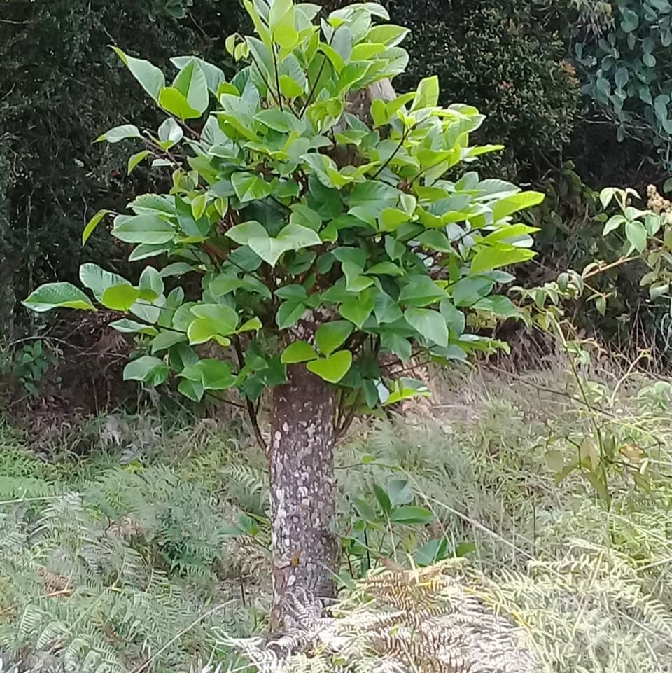
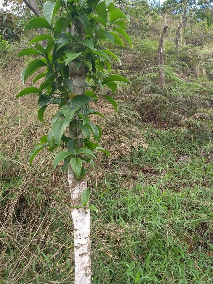
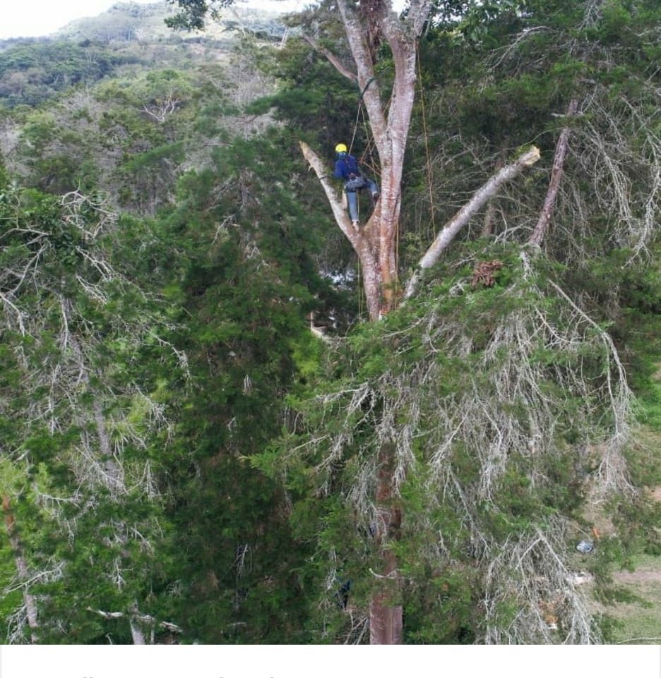
To plant nuclei, we used large 2m tall vegetative cuttings or stakes. Vegetative cuttings have long been used by farmers to establish live fence rows, and a number of species are known to establish in this manner. Advantages to using this method include: (i) it obviates many precursor steps, including seed collection, seedling establishment and growth in nurseries, and a hardening phase, saving at least ~6 months; (ii) no maintenance in the field, such as clearing of grasses to reduce competition, irrigation, or protection from herbivores; (iii) stakes develop a canopy crown and roots quickly, creating improved microclimatic conditions for natural recruitment and reducing soil erosion on steeper slopes; (iv) all species are hardy and can tolerate the adverse soil conditions in degraded plots; most seedlings would do poorly; and (v) cuttings from adult trees often results in the development of fruit 1-2 yr later, a potential attractant to frugivores and dispersers such as birds and bats. All species are native and many have a number of important functional traits such as fleshy fruit, N-fixation, copious litter production, or fast growth.
How this project recovered ecosystem functionality (e.g. nutrient cycling, plant-animal interactions, normal stressors):
We hope to monitor changes in ecosystem functionality in the coming years
Activities were undertaken to address any socio-economic aspects of the project:
Activities carried out to address socio-economic aspects of the project include cooperation with the community of nature reserves of civil society and municipal authorities.
Ecological Outcomes Achieved
Reinstate appropriate physical conditions",:
We have been measuring the changes in the physical conditions of the assembled nuclei duirng the last year and we have found promising results, although it is still too early to obtain conclusive ones.
Reinstate structural diversity:
While it is early to conclude that structural diversity has been restored, we have found evidence that avifauna has started to use the planted stakes as perches and has contributed to seed dispersal
Factors limiting recovery of the ecosystem:
Factors that currently limit the recovery of the ecosystem include the poverty of the remnant soils, the changing and sometimes extreme climate, as well as the aggressiveness of the ferns and the foreign forage species.
Socio-Economic & Community Outcomes Achieved
Economic vitality and local livelihoods:
Since last year we have been checking if the natural reserves have had changes in their economies and livelihoods. So far we can presume changes in the perception of locals and tourists, in reference to natural attractions as well as water availability for consumption in rural sites
Cultural dimensions such as recreational, aesthetic and/or spiritual:
The potential for recreation and aesthetic values has increased.
Has the project had any negative consequences for surrounding communities or given rise to new socio-economic or political challenges?:
None so far.
Key Lessons Learned
The lessons learned include the recognition of the poverty of the substrata (mistreated by decades of livestock and natural topography), the potential of some plant species (some foreign ones are affected), as well as the failure of some other natives whose responses we had anticipated better than those obtained.
Long-Term Management
The University is developing plans to monitor the implementation and maintain the assemblies in the long term. For now, the University and the members of the natural reserves are responsible for these activities and we maintain the commitment to continue these processes.
Sources and Amounts of Funding
So far we have WWF funding to the Foundation ProZpataoca for the first setup, and then, we have had two small grants from the University to monitor some ecosystem services, the progress of the stakes and the ecosystem.
Other Resources
https://www.facebook.com/Semillero-en-Conservaci%C3%B3n-y-Restauraci%C3%B3n-de-Ecosistemas-Unalmed-921603184547774/
https://www.instagram.com/semillero.cyr.unalmed/
Related Research
Small grants and participation in SER in Brazil have opened the possibility of continuing our monitoring and restoration plans for new areas.Primary Contact
Name:
Jaime Polanía
Affiliation:
Universidad Nacional de Colombia Sede Medellín
City:
Medellin
State:
ANTIOQUIA