Overview
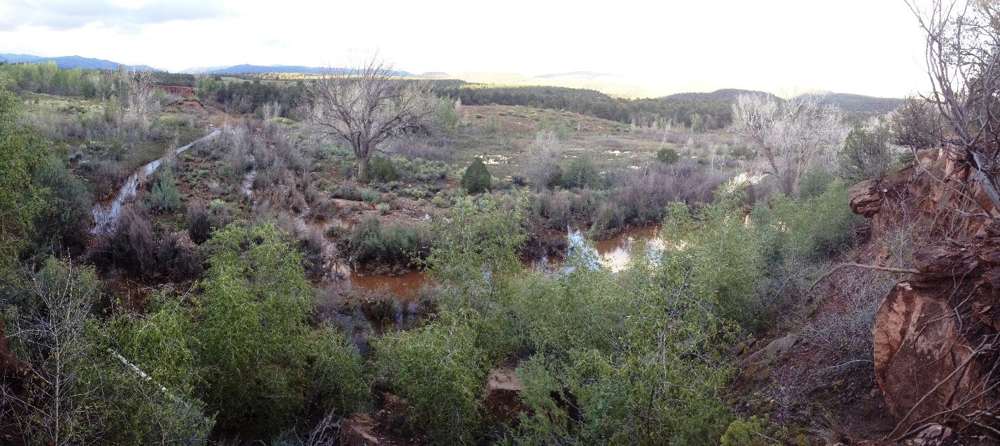
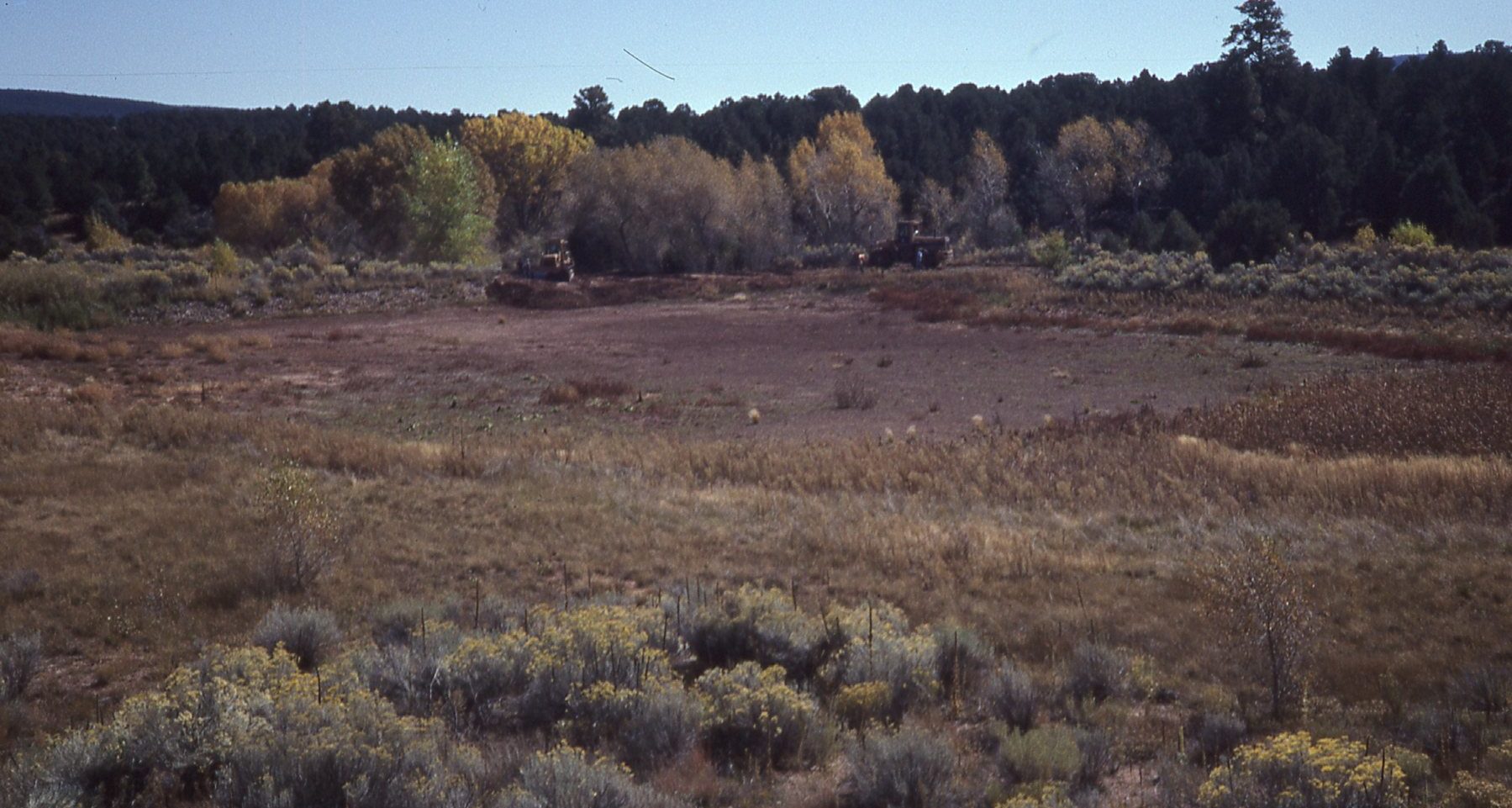
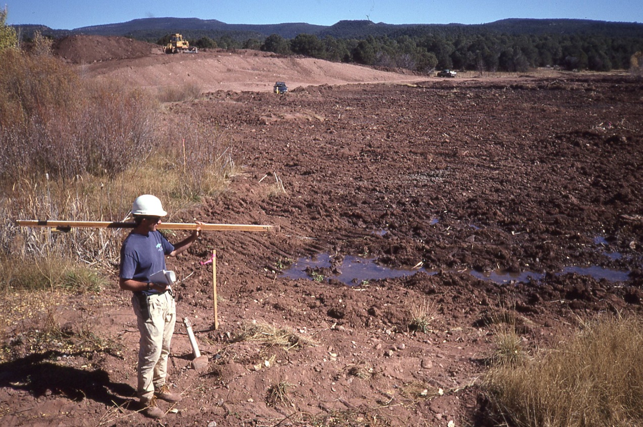
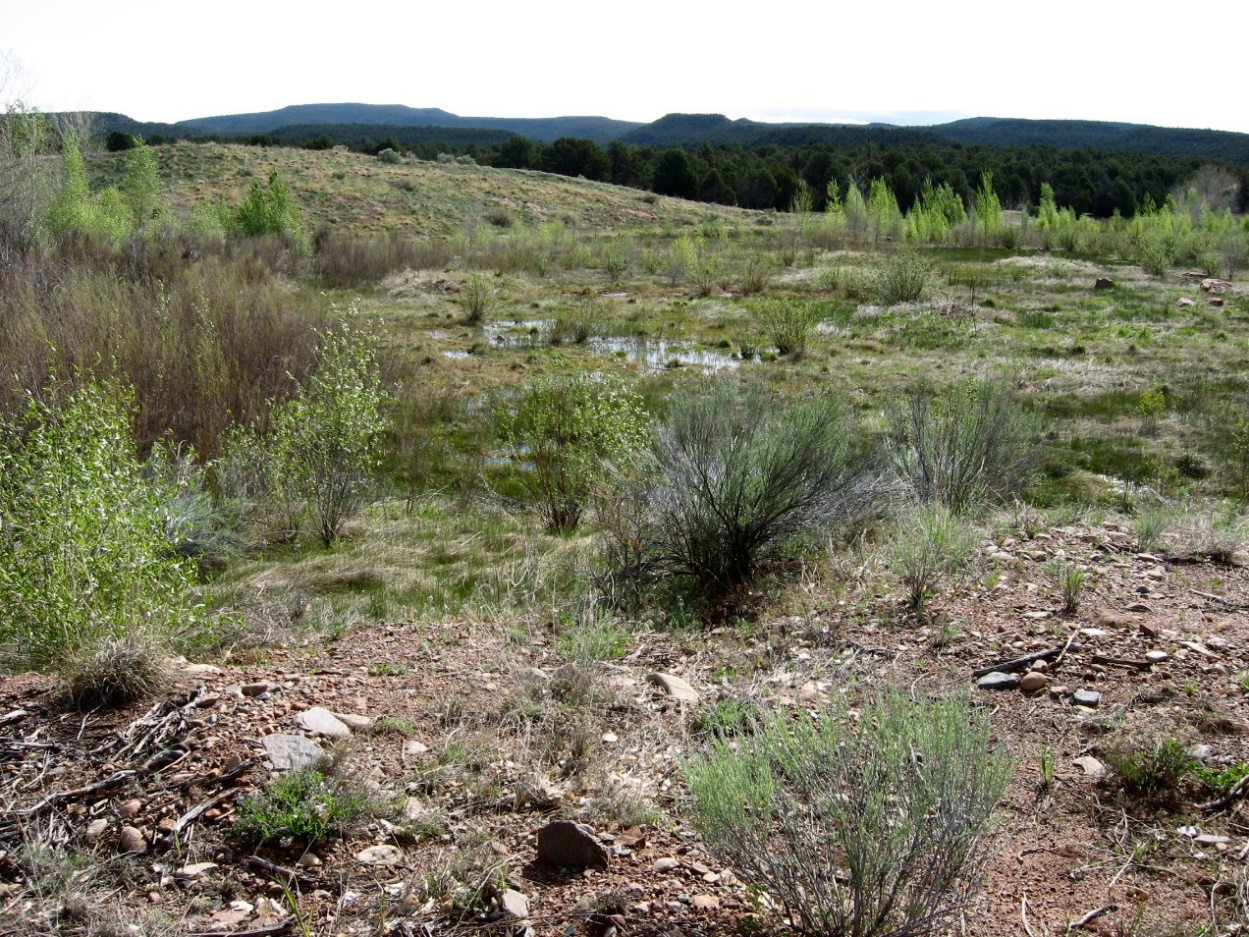
This project was focused on restoring the floodplain and terraces along Glorieta Creek within Pecos National Historical Park (NHP), which is located in northern New Mexico (United States) near the town of Pecos. Pecos NHP is near the intersection of the Rocky Mountains, Great Plains, and Sonoran Desert physiographic provinces at an elevation of approximately 7000 feet. The project encompassed a half-mile stretch of floodplain and terraces along lower Glorieta Creek, which was mined for sand and gravel before becoming part of the park. Once mining ended in the mid-1980s, ranchers bulldozed the remaining material into levees and created two reservoirs, further degrading the hydrological and ecosystem functions of the area. The main goal of the project was to restore hydrological function by removing the levees and reservoirs and recontouring the creek channel. Starting in 1999 the National Park Service and its partners removed fill and parts of the levee. They also and completed a number of restoration actions including planting trees and native grasses. The project resulted in improved hydrologic functioning of the creek and a thriving native riparian plant community that was healthy until the recent long-term drought within the region.
Quick Facts
Project Location:
Pecos National Historical Park, New Mexico 63, Pecos, NM, USA, 35.5416823, -105.6780592, 3, ChIJ-SSYZGAAGYcRSlQyMKzdBvc, Pecos National Historical Park, 1, New Mexico 63, NM-63, Pecos, New Mexico, NM, 87552, United States, US
Geographic Region:
North America
Country or Territory:
United States of America
Biome:
Desert/Arid Land
Ecosystem:
Freshwater Rivers & Streams
Area being restored:
10 hectares
Project Lead:
National Park Service
Organization Type:
Governmental Body
Project Partners:
Colorado State University
Location
Project Stage:
Completed
Start Date:
1999
End Date:
2016
Primary Causes of Degradation
Dams & Hydrology, Invasive Species (native or non-native pests, pathogens or plants), Mining & Resource Extraction, OtherDegradation Description
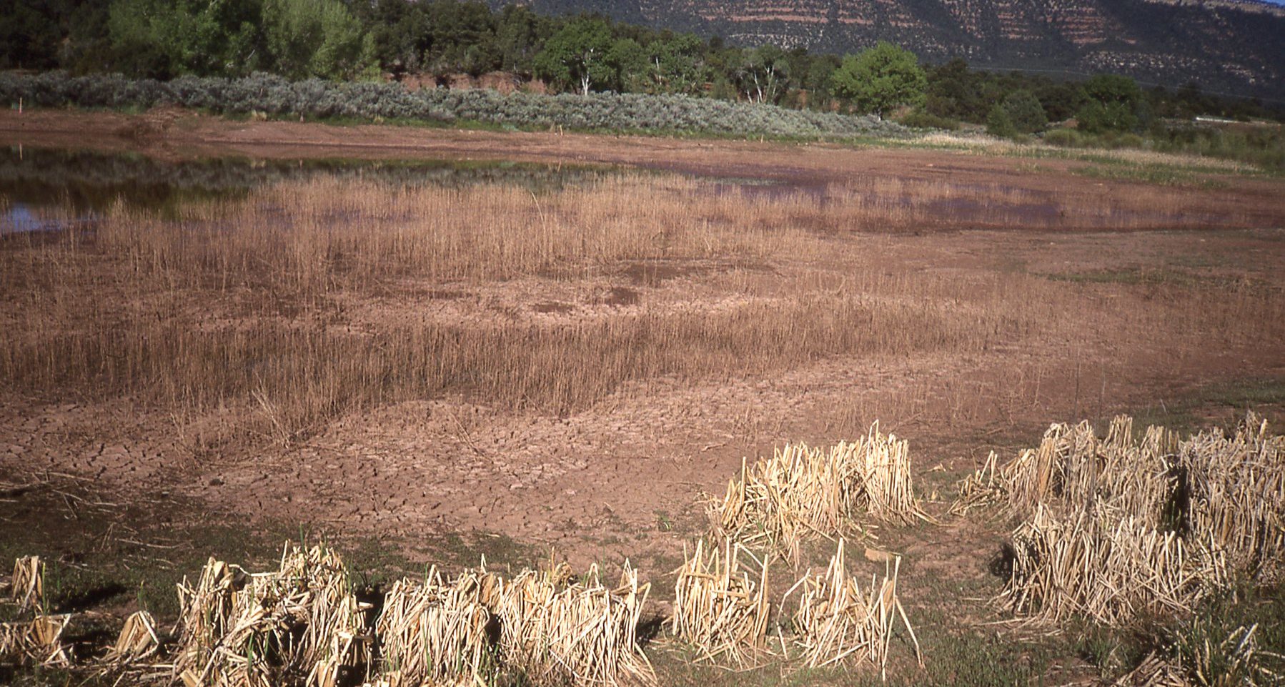
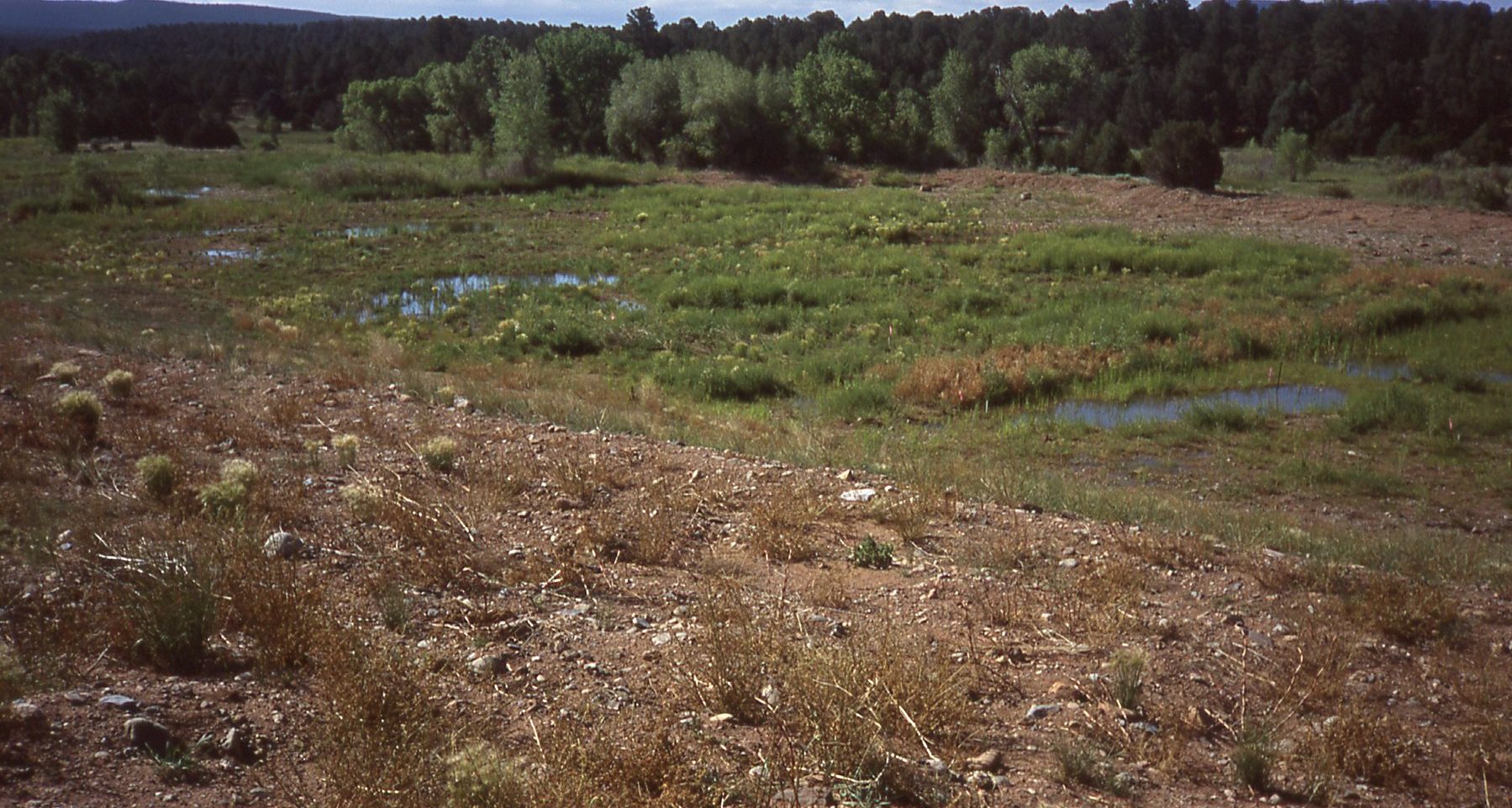
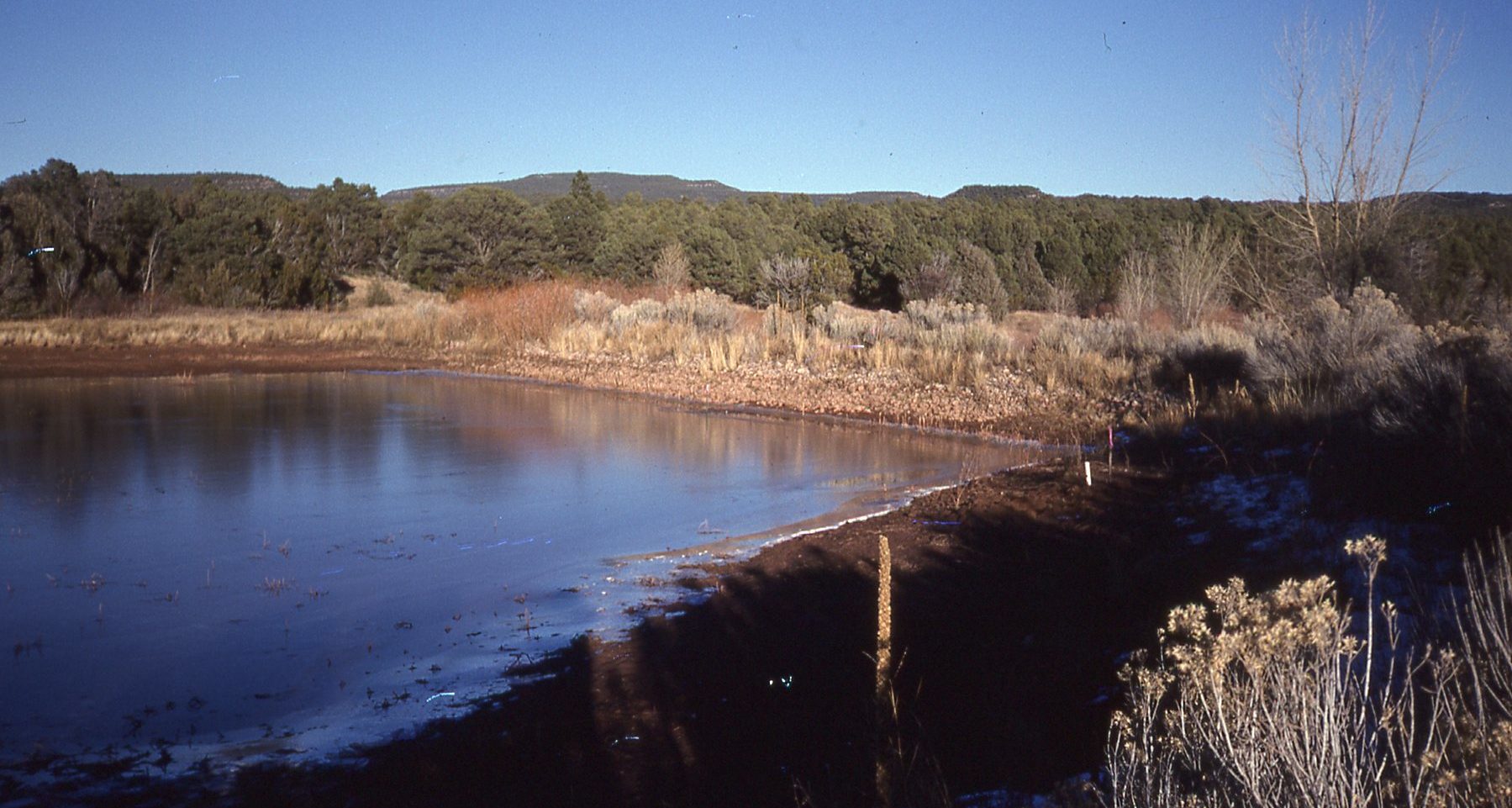
This area of Glorieta Creek was mined for sand and gravel before becoming part of Pecos National Historic Park. Once mining ended in the mid-1980s, ranchers bulldozed the remaining spoils material into levees and created two reservoirs on 5.6 acres. The reservoirs soon became a threat to the hydrologic functionality of Glorieta Creek. Floodwaters periodically swept thousands of fish from the creek into the reservoirs, where they were trapped and later died as the ponds dried. Flooding also caused breaches in the progressively weakening levees, washing sediment into the creek and toward the Pecos River approximately 0.5 mile downstream. Due to mining, ranching, and erosion disturbances, invasive plant species had colonized the degraded areas leading to a loss of native vegetation and wildlife habitat.
Reference Ecosystem Description
The main threats included erosion, flooding, loss of wildlife/plant habitat, invasive species, and degraded water quality. The project area was experiencing erosion of the levees, leading to flooding and water quality degradation. Flooding and erosion were reducing native vegetation cover while increasing invasive plant cover, as well as driving mortality events in which aquatic wildlife species became trapped and died in flooder reservoirs that later dried up. This section of Glorieta Creek was degraded due to issues with damming of the creek channel, erosion, flooding, loss of native vegetation, and spread of invasive species. The area was experiencing a loss of structural diversity, driven by a loss of native vegetation due to flooding, erosion, and invasive species colonization. Due to the levees and reservoirs placed in the creek channel, external exchanges were limited.
Project Goals
The project’s primary goals are to improve hydrological function of this stretch of Glorieta Creek – by connecting segmented or blocked sections of the creek – and restore the disturbed areas to native riparian plant communities that can also support birds and other faunal populations that depend on riparian habitat.
Monitoring
The project does not have a monitoring plan.
Stakeholders
Consultation with the parks traditionally associated Tribes was completed throughout the project. Other stakeholders included nonprofit citizen groups, government, and youth who contributed knowledge on methods, implementation, and ecological conditions and successional patterns.
How this project eliminated existing threats to the ecosystem:
The main threats included erosion, flooding, loss of wildlife/plant habitat, invasive species, and degraded water quality. This was addressed by excavating soil from levees and reservoirs to recontour the site to allow the restoration of the creek's hydraulic function and by planting native riparian/wetland species across the disturbed areas to restore biodiversity and improve habitat
How this project reinstated appropriate physical conditions (e.g. hydrology, substrate)",:
The project area was experiencing erosion of the levees, leading to flooding and water quality degradation. This was addressed by excavating soil from levees and reservoirs to recontour the site and restore the hydraulic function.
How this project achieved a desirable species composition:
Flooding and erosion were reducing native vegetation cover, while increasing invasive plant cover. Aquatic wildlife species were also being killed due to flooding/erosion and subsequent drying of reservoirs where they were trapped. This was addressed by excavating soil from levees and reservoirs to recontour the site as we as by planting native riparian/wetland species across the disturbed areas.
How this project reinstated structural diversity (e.g. strata, faunal food webs, spatial habitat diversity):
The area was experiencing a loss of structural diversity as native vegetation was lost due to flooding, erosion, and invasive species colonization. This was addressed by installing native riparian/wetland species across the disturbed areas to restore structural diversity.
How this project recovered ecosystem functionality (e.g. nutrient cycling, plant-animal interactions, normal stressors):
This section of Glorieta Creek was degraded due to issues with damming the creek channel, erosion, flooding, loss of native vegetation, and invasive species. This was addressed by reintroducing native riparian/wetland species and using soil from levees and reservoirs to recontour the physical structure of the site.
How this project reestablished external exchanges with the surrounding landscape (e.g. migration, gene flow, hydrology):
Due to the levees and reservoirs placed in the creek channel external exchanges were limited. These exchanges were reestablished by excavating the soil from the levees and reservoirs, and recontouring the site in order to rebuild the hydraulic function.
Ecological Outcomes Achieved
Eliminate existing threats to the ecosystem:
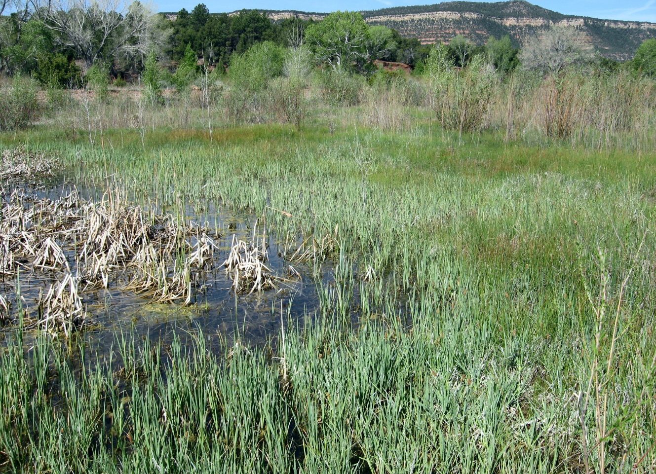
Improving the hydrologic function and reintroducing riparian species has eliminated some of the threats to the ecosystem. Drought has continued to be a threat and has caused setbacks in native plant survival and cover, which in turn has negatively impacted wildlife habitat and forage.
Reinstate appropriate physical conditions",:
Physical conditions were successfully reinstated
Achieve a desirable species composition:
This has largely been successful, with the introduction of riparian species. Drought has led to setback in native plant survival.
Reinstate structural diversity:
This has largely been successful, with the introduction of riparian species. Drought has led to setback in native plant survival.
Recover ecosystem functionality:
This has largely been successful, with the improvement of hydrologic function and introduction of riparian species. Drought has led to setback in native plant survival and cover, which has negatively impacted wildlife habitat and forage.
Reestablish external exchanges with the surrounding landscape:
External exchanges have been reestablished with the renewal of functional hydrology.
Factors limiting recovery of the ecosystem:
Drought continues to limit the recovery of this ecosystem.
Socio-Economic & Community Outcomes Achieved
Key Lessons Learned
Multiple lessons were learned through this project, the first of which was the realization that a portion of the upper levee along Glorieta Creek needed to be left in place to protect the newly excavated and planted site from flood erosion until soil-stabilizing vegetation could take hold. In 2007, it was determined that sufficient plant establishment had occurred to allow the removal of the remaining levee segment separating Glorieta Creek from the adjacent, restored floodplain. This provided an opportunity to fully restore natural channel-floodplain processes and functions. The establishment of the plant community also decreased the ongoing threat of levee erosion during floods, which could result in massive sediment deposition into the restored wetland-riparian area, Glorieta Creek, and the Pecos Wild and Scenic River immediately downstream. A second challenge was severe, multiyear drought that had an impact on seeding and planting survival, as well as water levels. Observations showed extensive damage and mortality to previously outplanted cottonwoods and willows during this time. These observations resulted in the decision to delay additional plantings until soil moisture conditions were adequate to support plant growth and establishment.
Long-Term Management
Monitoring for this project included periodic site reviews of how the restoration efforts were performing. These reviews led to adaptive management in the form of phasing levee removal until plants were well established and holding over plantings until drought conditions lessened.
Sources and Amounts of Funding
This project was funded by the National Park Service.
Primary Contact
Name:
Jeremy Moss
Affiliation:
U.S. National Park Service
City:
Pecos
State:
New Mexico