Overview
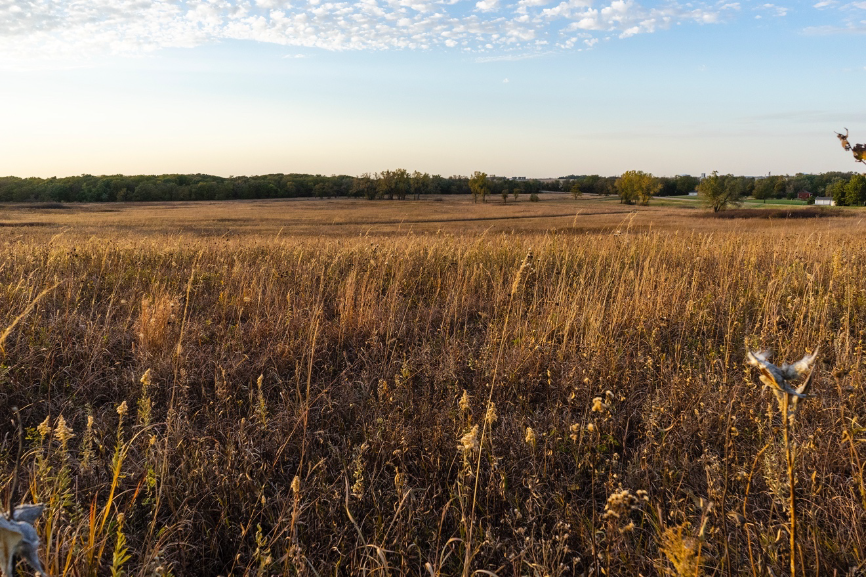
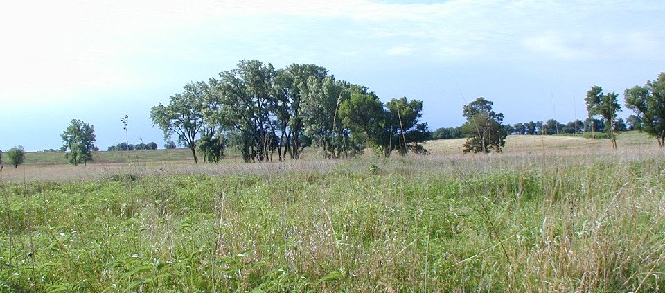
Homestead National Historical Park (formerly Homestead National Monument of America) in southeastern Nebraska was established in 1936 at the site of Daniel Freeman’s original homestead from 1863. Encompassing 100 acres of tallgrass prairie that had been converted into agricultural land and 60 acres of woodland fringing a creek, the monument underwent restoration by the National Park Service in 1939 in an attempt to restore the prairie that Freeman would have discovered upon his arrival at the site. Ongoing for more than 75 years, the Homestead restoration is the nation’s second oldest tallgrass prairie restoration project. Restoration efforts currently involve periodic burning and removal of invasive plant species. Recent National Park Service monitoring activities documented that the restored Homestead Prairie exhibits the species diversity and distribution characteristic of a functioning native prairie.
Quick Facts
Project Location:
8525 NE-4, Beatrice, NE 68310, USA, 40.2913841, -96.8357934, 3, ChIJTxgAEWBblocR6saVojl6Tdc, 8525, Nebraska 4, NE-4, Beatrice, Nebraska, NE, 68310, United States, US
Geographic Region:
North America
Country or Territory:
United States of America
Biome:
Grassland/Savanna
Ecosystem:
Grasslands & Savannas - Temperate
Area being restored:
40 hectares
Project Lead:
National Park Service
Organization Type:
Governmental Body
Project Partners:
Dr. John E. Weaver, University of Nebraska-Lincoln, National Resource Conservation Service (NRCS)
Location
Project Stage:
Post-Implementation Maintenance
Start Date:
1940s
End Date:
continuous monitoring/maintenance
Primary Causes of Degradation
Agriculture & Livestock, Fragmentation, Invasive Species (native or non-native pests, pathogens or plants)Degradation Description
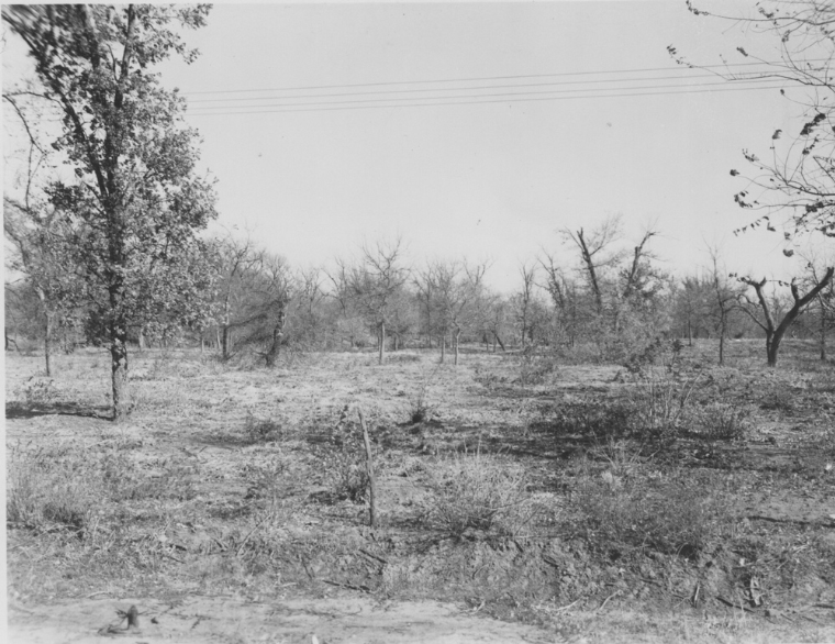
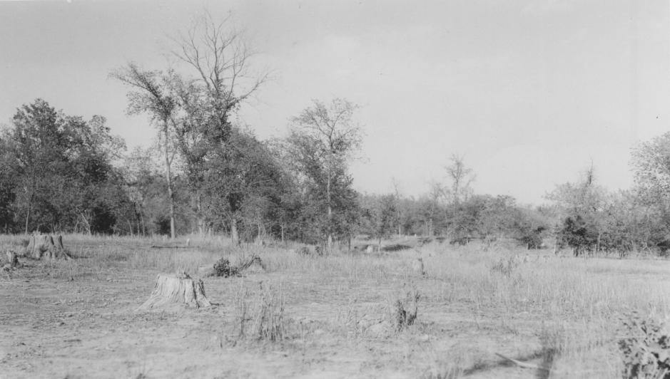
When Homestead National Historical Park was established by Congress in 1936, the upland slopes of the site were severely eroded, the lower slopes were covered with heavy depositions of silt, and the woodlands had been logged and heavily grazed. At least 40 acres of the site were under agriculture cultivation until 1939. Current threats to the park are mainly attributed to invasive species, altered fire and grazing regimes, edge effects (from being a small, protected area surrounded by agriculture) and climate change. These disturbances have led to reductions in soil productivity, water quality, and native plant and wildlife habitat and diversity.
Defining the Reference Ecosystem
I’m not sure.Project Goals
Alter species composition (plant, animal, and undesired species)
Increase structural diversity (vegetation, trophic levels, spatial mosaic)
Improve ecosystem function (productivity, habitat, resilience)
Remove threats (contamination, invasive species, over-utilization)
Improve physical conditions (substrate physical, substrate chemical, water chemo-physical)
Monitoring
Monitoring Details:
Yes, see DataStore - Protocol Narrative - (Code: 573182) (nps.gov): https://irma.nps.gov/DataStore/Reference/Profile/573182
End Date:
Ongoing
Stakeholders
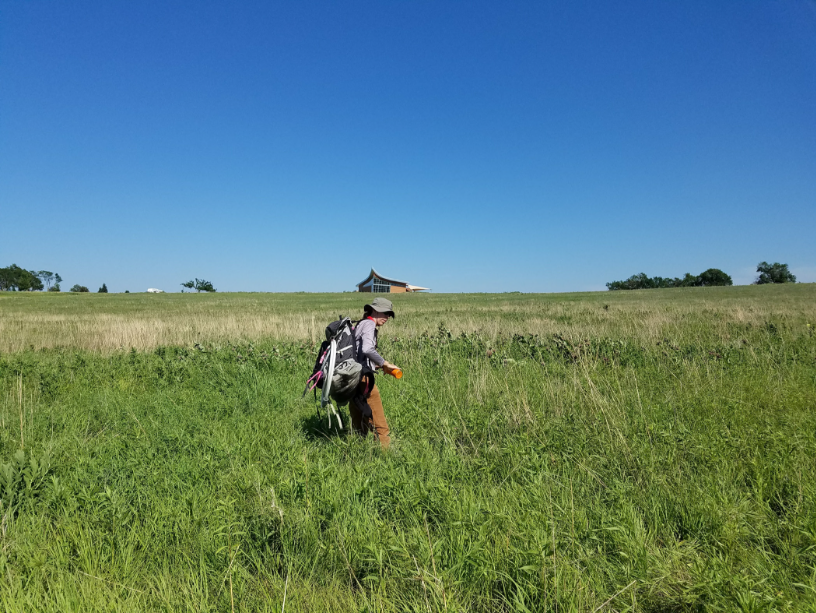
The stakeholders who were engaged included: the local Indigenous community, the local community or project neighbours, private landowners, citizen scientists from the University of Nebraska-Lincoln, and Government (NRCS). These stakeholders helped prioritize distribution of restoration actions on the landscape, helped set project goals, objectives, targets, or vision, contributed knowledge on methods or implementation, contributed knowledge about ecological conditions or successional patterns, and engaged in participatory monitoring. For more recent restoration activities Tribes have been consulted. Microsoft Word – adhi.docx (npshistory.com): http://npshistory.com/publications/home/adhi-2020.pdf
How this project eliminated existing threats to the ecosystem:
Invasive species: 1943- Weed control was implemented; sunflowers were mowed, and bindweed was treated with sodium chlorate. 1955- Smooth bromegrass infestation was noted. 1963- 2,4-D was used for weed control. 1964- Lowlands were heavily infested with weeds. Dalapon was used for smooth brome control and 2,4-D was applied for broadleaf weed control. 1968- Smooth brome was mowed. 1979- Woody plants were sprayed with ammonium sulfamate; routine 2,4-D spraying program stopped. 1984- Weedy lowland area was mowed. Currently, the park monitors for nonnative species in the prairie and woodland areas of the monument and uses a combination of techniques, including mowing, selective use of herbicides, and prescribed fire, to manage these areas.
Agricultural & Livestock: Livestock access to the site has been managed by the park throughout the project.
How this project reinstated appropriate physical conditions (e.g. hydrology, substrate)",:
1942- Additional seeding and sodding occurred, along with the construction of small check dams to slow erosion. 1947- Sodding occurred in upland gullies; seeding and local prairie hay mulch was used in eroding areas
How this project achieved a desirable species composition:
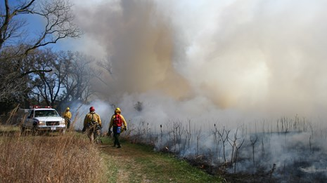
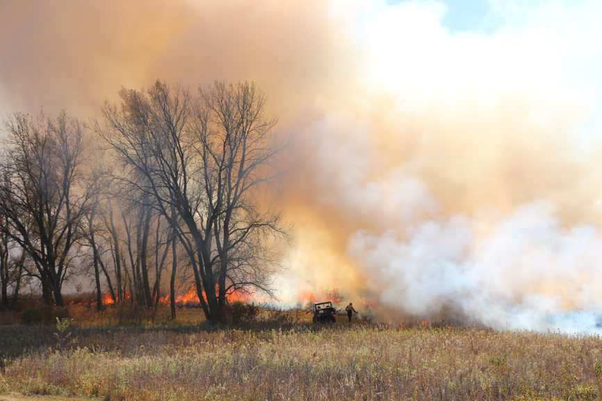
1939- Park records indicate that the first seeding took place in 1939 with seed gathered from a prairie located approximately 5 miles to the west. The approximate seed mixture was 45% big bluestem, 50% little bluestem, and 1% each of Kentucky bluegrass, needle and thread grass, indiangrass, prairie dropseed, and sideoats grama. This original restoration also included the installation of native plant plugs and the transplantation of sod from nearby areas of un-ploughed prairie in an attempt to control severe sheet, rill, and gully erosion on the coarse-textured south upland slopes. The source of the sod is unknown. 1942- Additional seeding and sodding occurred, along with the construction of small check dams to slow erosion. 1943- Weed control was implemented; sunflowers were mowed, and bindweed was treated with sodium chlorate. 1948- Additional spot seeding occurred; sod was added to the uplands; selective grazing was suggested as a means of reducing fire hazard. 1949- First use of herbicide other than sodium chlorate (2,4-D). 1951- 40 acres were mowed. 1952- Upland areas were hayed. 1953- Bottomland areas were hayed. 1954- Native seeds were harvested. 1955- Smooth bromegrass infestation was noted. 1963- 2,4-D was used for weed control. 1959- First Vegetation Management Plan was drafted to guide future actions (e.g., mowing, reseeding, planting, burning, weed control) at the park in the ongoing effort to recreate the natural setting of the 1860s. 1964- Lowlands were heavily infested with weeds. Dalapon was used for smooth brome control and 2,4-D was applied for broadleaf weed control. 1965- Thatch buildup leads to complete mowing of the site. 1968- Smooth brome was mowed. 1969- 7-11 acres of lowland were seeded. 1970- First prescribed burn to manage the prairie; 2,4-D was applied. 1976- 4 acres of lowland areas were reseeded. 1979- Woody plants were sprayed with ammonium sulfamate; routine 2,4-D spraying program stopped. 1980- 17-acre wildfire occurred. 1982- Quantitative vegetative sampling began; prescribed burn was implemented in April (8 acres); manual removal of musk thistles and common mullein. 1983- Entire prairie was burned, 4 acres of weedy lowland were mowed. 1984- Weedy lowland area was mowed; fall burn of small overgrown sumac implemented; herbarium was assembled; local native seed and sod was collected. 1986- Lowland area sodded and planted with approximately 3,000 greenhouse grown seedlings from locally collected prairie seed. Prescribed burning began in 1970. The prairie is divided into six management units and burned on a seven-year cycle. Every year, two units are randomly chosen for treatment, with the stipulation that once a unit has been burned twice in the seven-year period, it is removed from consideration for the duration of that period. Seasonality of fires is also randomized. The seventh year is a “rest year”. The goals of the fire management program are control of invasive nonnative species such as smooth brome, management of shrub species to no more than 15% of the prairie by area, and removal of plant debris that, if left in place, creates the potential for a large, devastating fire.
How this project reinstated structural diversity (e.g. strata, faunal food webs, spatial habitat diversity):
This was addressed by reintroducing a prescribed burning cycle. 1968- Smooth brome was mowed. 1979- Woody plants were sprayed with ammonium sulfamate; routine 2,4-D spraying program stopped. 1980- 17-acre wildfire occurred. 1982- Quantitative vegetative sampling began; prescribed burn was implemented in April (8 acres); manual removal of musk thistles and common mullein. 1983- Entire prairie was burned, 4 acres of weedy lowland were mowed. 1984- Weedy lowland area was mowed; fall burn of small overgrown sumac implemented; herbarium was assembled; local native seed and sod was collected. Prescribed burning began in 1970. The prairie is divided into six management units and burned on a seven-year cycle. Every year, two units are randomly chosen for treatment, with the stipulation that once a unit has been burned twice in the seven-year period, it is removed from consideration for the duration of that period. Seasonality of fires is also randomized. The seventh year is a “rest year”. The goals of the fire management program are control of invasive nonnative species such as smooth brome, management of shrub species to no more than 15% of the prairie by area, and removal of plant debris that, if left in place, creates the potential for a large, devastating fire.
How this project recovered ecosystem functionality (e.g. nutrient cycling, plant-animal interactions, normal stressors):
This was addressed by reintroducing a prescribed burning cycle. 1968- Smooth brome was mowed. 1979- Woody plants were sprayed with ammonium sulfamate; routine 2,4-D spraying program stopped. 1980- 17-acre wildfire occurred. 1982- Quantitative vegetative sampling began; prescribed burn was implemented in April (8 acres); manual removal of musk thistles and common mullein. 1983- Entire prairie was burned, 4 acres of weedy lowland were mowed. 1984- Weedy lowland area was mowed; fall burn of small overgrown sumac implemented; herbarium was assembled; local native seed and sod was collected. Prescribed burning began in 1970. The prairie is divided into six management units and burned on a seven-year cycle. Every year, two units are randomly chosen for treatment, with the stipulation that once a unit has been burned twice in the seven-year period, it is removed from consideration for the duration of that period. Seasonality of fires is also randomized. The seventh year is a “rest year”. The goals of the fire management program are control of invasive nonnative species such as smooth brome, management of shrub species to no more than 15% of the prairie by area, and removal of plant debris that, if left in place, creates the potential for a large, devastating fire.
Ecological Outcomes Achieved
Achieve a desirable species composition:
Today, the species composition of the tallgrass prairie at Homestead resembles that of pre-settlement times. In fact, plant diversity is greater in the oldest sections of the restored prairie than in some native prairie remnants in the area. There are 116 plant species present at the site, and dominant species include big bluestem, little bluestem, Indiangrass, switchgrass, goldenrod, field pussytoes, and leadplant. Interspersed within the prairie are thickets of shrubby species such as sumac, wild plum, and dogwood, which provide habitat for birds and other small animals. A 2007 National Park Service report presented the findings of sampling exercises conducted at monitoring sites between 1998 and 2006. Based on the data collected at these sites, it was concluded that the 100 acres of restored prairie at Homestead National Monument reflect the species richness and diversity of the prairie's historic source and native species augmentation. It is a species-rich plant community with a distribution pattern composed of core and satellite species. Although it is difficult to make a quantitative comparison of the restored prairie with a mid-1860s prairie, the diversity and distribution of species reflects a functioning native prairie.
Reinstate structural diversity:
Dominant species now include big bluestem, little bluestem, Indiangrass, switchgrass, goldenrod, field pussytoes, and leadplant. Interspersed within the prairie are thickets of shrubby species such as sumac, wild plum, and dogwood.
Socio-Economic & Community Outcomes Achieved
Key Lessons Learned
Since the establishment of Homestead National Historical Park, many different invasive plant species have colonized the site. The species have required different methods of treatment, including changes in herbicides utilized as some toxic chemicals were phased out over time. Managers have also fine tuned the use and timing of fire and mowing on the landscape to achieve restoration goals.
Long-Term Management
Monitoring has been done on plant composition/species cover, erosion, and effects of burning, invasive plant removal, and seeding/planting operations. Results from monitoring have been used throughout the many years of restoration activities to adapt and plan for future seeding, planting, sod installation, burning operations, and invasive plant control.
Sources and Amounts of Funding
Funding has come from the United States National Government, through the National Park Service. The global project cost is unknown, but is estimated to be between $150,000 and $500,000.
Other Resources
DataStore – Protocol Narrative – (Code: 573182) (nps.gov):https://irma.nps.gov/DataStore/Reference/Profile/573182
Microsoft Word – adhi.docx (npshistory.com):http://npshistory.com/publications/home/adhi-2020.pdf
Primary Contact
Name:
Jesse Bolli
Affiliation:
National Park Service
City:
Beatrice
State:
Nebraska